MyTopo
Graphite New York US Topo Map
Couldn't load pickup availability
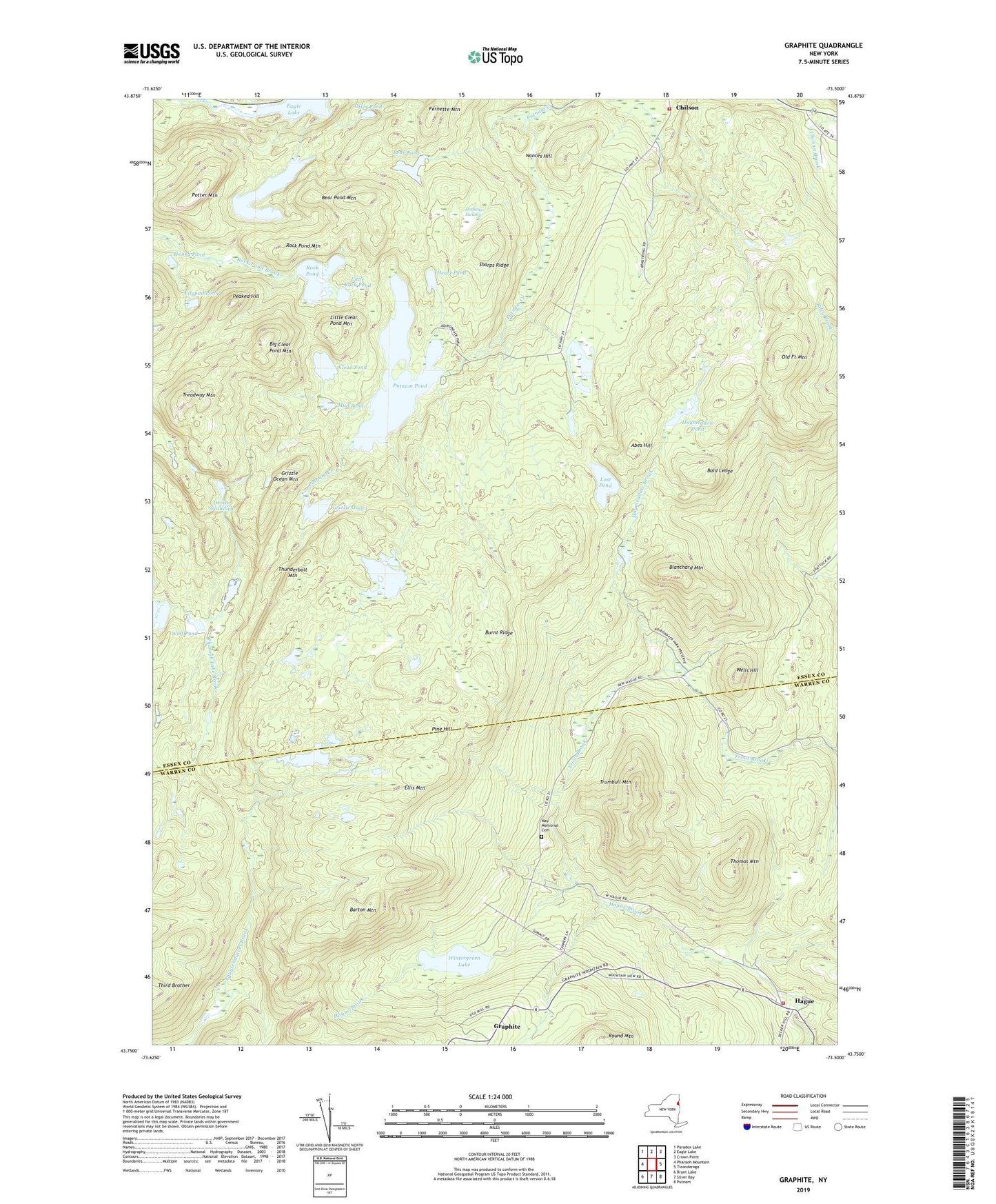
2019 topographic map quadrangle Graphite in the state of New York. Scale: 1:24000. Based on the newly updated USGS 7.5' US Topo map series, this map is in the following counties: Essex, Warren. The map contains contour data, water features, and other items you are used to seeing on USGS maps, but also has updated roads and other features. This is the next generation of topographic maps. Printed on high-quality waterproof paper with UV fade-resistant inks.
Quads adjacent to this one:
West: Pharaoh Mountain
Northwest: Paradox Lake
North: Eagle Lake
Northeast: Crown Point
East: Ticonderoga
Southeast: Putnam
South: Silver Bay
Southwest: Brant Lake
Contains the following named places: Abes Hill, Bald Ledge, Barton Mountain, Bear Pond, Bear Pond Mountain, Bear Pond Trail, Berrymile Pond Trail, Berrymill Pond, Big Clear Pond Mountain, Blanchard Mountain, Burnt Ridge, Chilson Volunteer Fire Department, Clear Pond, Clear Pond Trail, Cranberry Marsh, Devils Washdish, Ellis Mountain, Fernette Mountain, Gooseneck Pond, Graphite, Grizzle Ocean, Grizzle Ocean Mountain, Hague Volunteer Fire Department and Emergency Squad Station 1, Haymeadow Brook, Haymeadow Pond, Heart Pond, Honey Pond, Lilypad Pond, Little Clear Pond Mountain, Little Rock Pond, Lost Pond, Lost Pond Trail, May Memorial Cemetery, Mud Pond, Nances Hill, North Pond, Old Fort Mountain, Otter Pond, Peaked Hill, Peshette Swamp, Pine Hill, Potter Mountain, Putnam Pond, Rock Pond, Rock Pond Mountain, Rock Pond Trail, Sharps Ridge, Short Swing Trail, Springhill Ponds, Thomas Mountain, Thunderbolt Mountain, Treadway Mountain, Treadway Mountain Trail, Trumbull Mountain, Wells Hill, Wintergreen Lake, Wolf Pond, ZIP Code: 12883