MyTopo
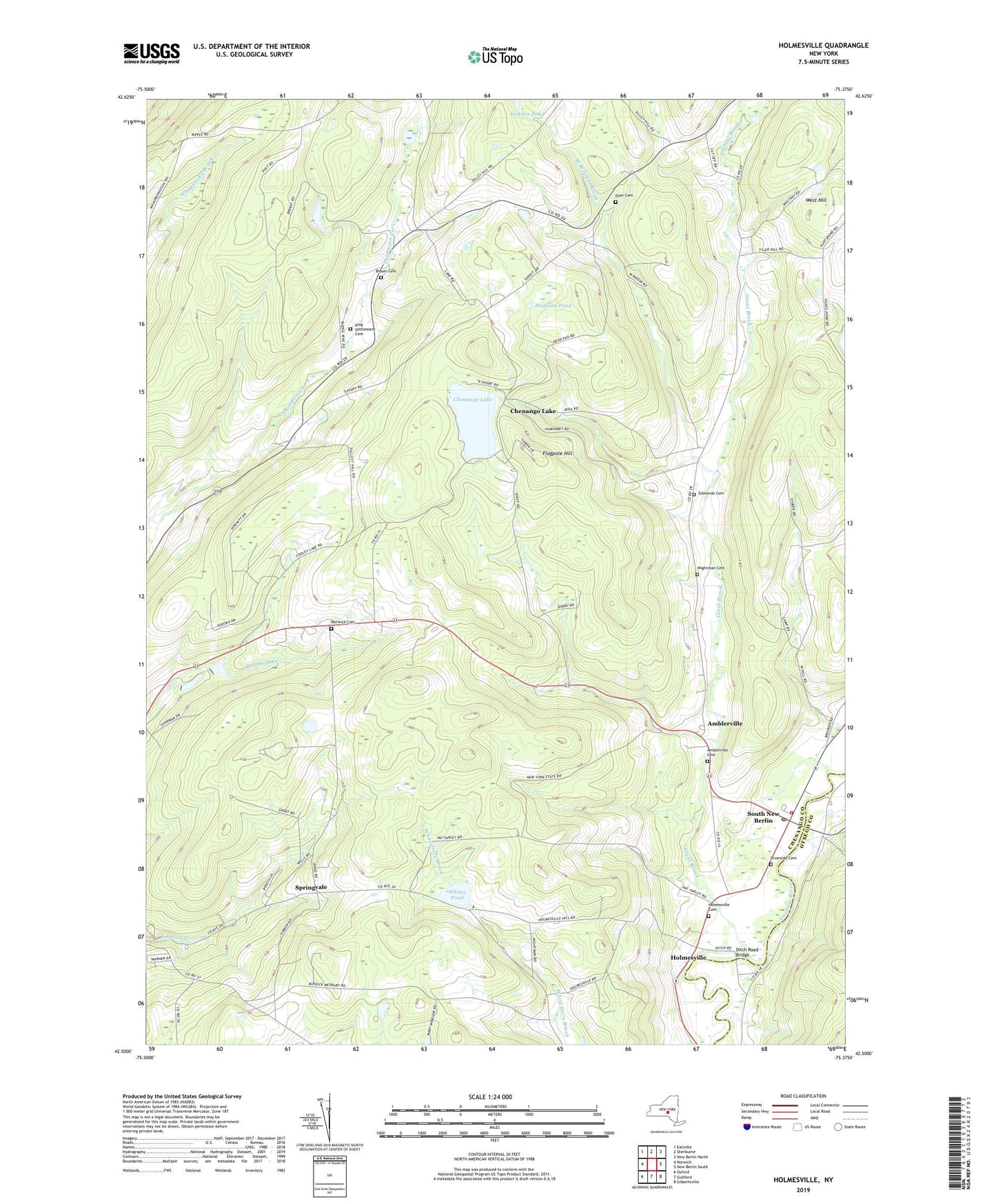
Holmesville New York US Topo Map
Couldn't load pickup availability
2019 topographic map quadrangle Holmesville in the state of New York. Scale: 1:24000. Based on the newly updated USGS 7.5' US Topo map series, this map is in the following counties: Chenango, Otsego. The map contains contour data, water features, and other items you are used to seeing on USGS maps, but also has updated roads and other features. This is the next generation of topographic maps. Printed on high-quality waterproof paper with UV fade-resistant inks.
Quads adjacent to this one:
West: Norwich
Northwest: Earlville
North: Sherburne
Northeast: New Berlin North
East: New Berlin South
Southeast: Gilbertsville
South: Guilford
Southwest: Oxford
Contains the following named places: Alishauskas Dairy, Amblerville, Amblerville Cemetery, Bloom Cemetery, Burwell Corners, Central School, Chenango Lake, Ditch Road Bridge, Dyer Cemetery, Edmonds Cemetery, Flagpole Hill, Great Brook, Hidden Ponds Stables, Holmesville, Holmesville Cemetery, King Settlement Cemetery, Kings Settlement, Madison Pond, Norwich Cemetery, Riverside Cemetery, School Number 11, School Number 2, School Number 6, School Number 7, South New Berlin, South New Berlin Free Library, South New Berlin Post Office, South New Berlin Volunteer Fire Department, Springvale, Town of New Berlin, Town of North Norwich, Town of Norwich, Union Church, WCHN-AM (Norwich), West Branch Great Brook, Whites Pond, Wightman Cemetery, WKXZ-FM (Norwich), ZIP Code: 13843