MyTopo
Hope Falls New York US Topo Map
Couldn't load pickup availability
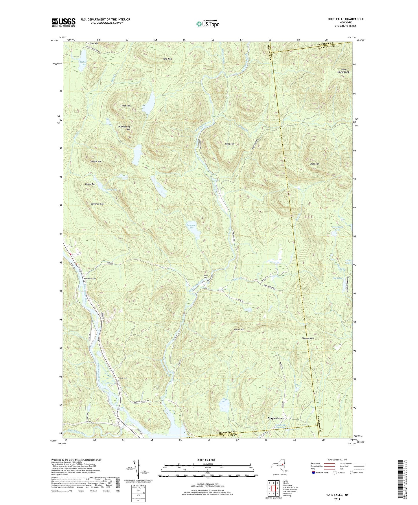
2019 topographic map quadrangle Hope Falls in the state of New York. Scale: 1:24000. Based on the newly updated USGS 7.5' US Topo map series, this map is in the following counties: Hamilton, Saratoga, Fulton, Warren. The map contains contour data, water features, and other items you are used to seeing on USGS maps, but also has updated roads and other features. This is the next generation of topographic maps. Printed on high-quality waterproof paper with UV fade-resistant inks.
Quads adjacent to this one:
West: Cathead Mountain
Northwest: Wells
North: Griffin
Northeast: Harrisburg
East: Ohmer Mountain
Southeast: Edinburg
South: Northville
Southwest: Jackson Summit
Contains the following named places: Bear Creek, Bennett Lake, Brownell Camp, Buck Mountain, East Stony Creek, Freds Mountain, Gene Edwards Mountain, Greenfield Lake, Hope, Hope Falls, Hope Volunteer Fire Department, Huckleberry Mountain, Jerry Vly, Little Lake, Maple Grove, Mason Hill, Middle Lake, Murphy Lake, Murphy Vly, Northville Reservoir, Old Pond, Pine Mountain, Rand Mountain, Round Top, Scribner Mountain, Sturgis Mountain, Tenant Creek, Thomas Hill, Town of Hope, Wadsworth Cemetery, West Stony Creek, Wilcox Outlet, Willard Cemetery, Willis Lake, ZIP Code: 12134