MyTopo
Jackson Summit New York US Topo Map
Couldn't load pickup availability
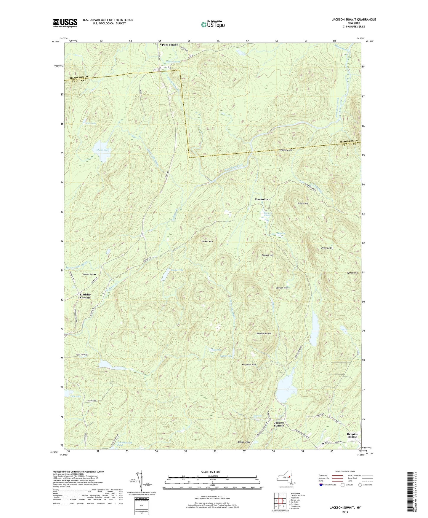
2023 topographic map quadrangle Jackson Summit in the state of New York. Scale: 1:24000. Based on the newly updated USGS 7.5' US Topo map series, this map is in the following counties: Fulton, Hamilton. The map contains contour data, water features, and other items you are used to seeing on USGS maps, but also has updated roads and other features. This is the next generation of topographic maps. Printed on high-quality waterproof paper with UV fade-resistant inks.
Quads adjacent to this one:
West: Caroga Lake
Northwest: Whitehouse
North: Cathead Mountain
Northeast: Hope Falls
East: Northville
Southeast: Broadalbin
South: Gloversville
Southwest: Peck Lake
This map covers the same area as the classic USGS quad with code o43074b3.
Contains the following named places: Bellan Ledge, Bernhardt Mountain, Berry Cemetery, Bleecker Cemetery, Bowlers Corners, Brower Hill, Buttermilk Falls, Cameron Reservoir, Chase Lake, Chase Lake Outlet, Dennies Hollow, Elphee Creek, Ferguson Mountain, Hartwell Swamp, Hatch Brook, Holmes Lake Outlet, Jackson Summit, Jackson Summit Reservoir, Johnson Swamp, Lawyer Mountain, Lily Lake, Lindsley Corners, Lynus Vly, Lynus Vly Outlet, Moat Vly, Mud Lake, North Branch West Stony Creek, Peters Mountain, Pinnacle, Racker Vly, Round Vly, Shaker Mountain, Steele Mountain, Tomantown, Trypoli Creek, Tyrrell Hill, Upper Benson, Whiskey Hill, ZIP Codes: 12078, 12117