MyTopo
Humphrey New York US Topo Map
Couldn't load pickup availability
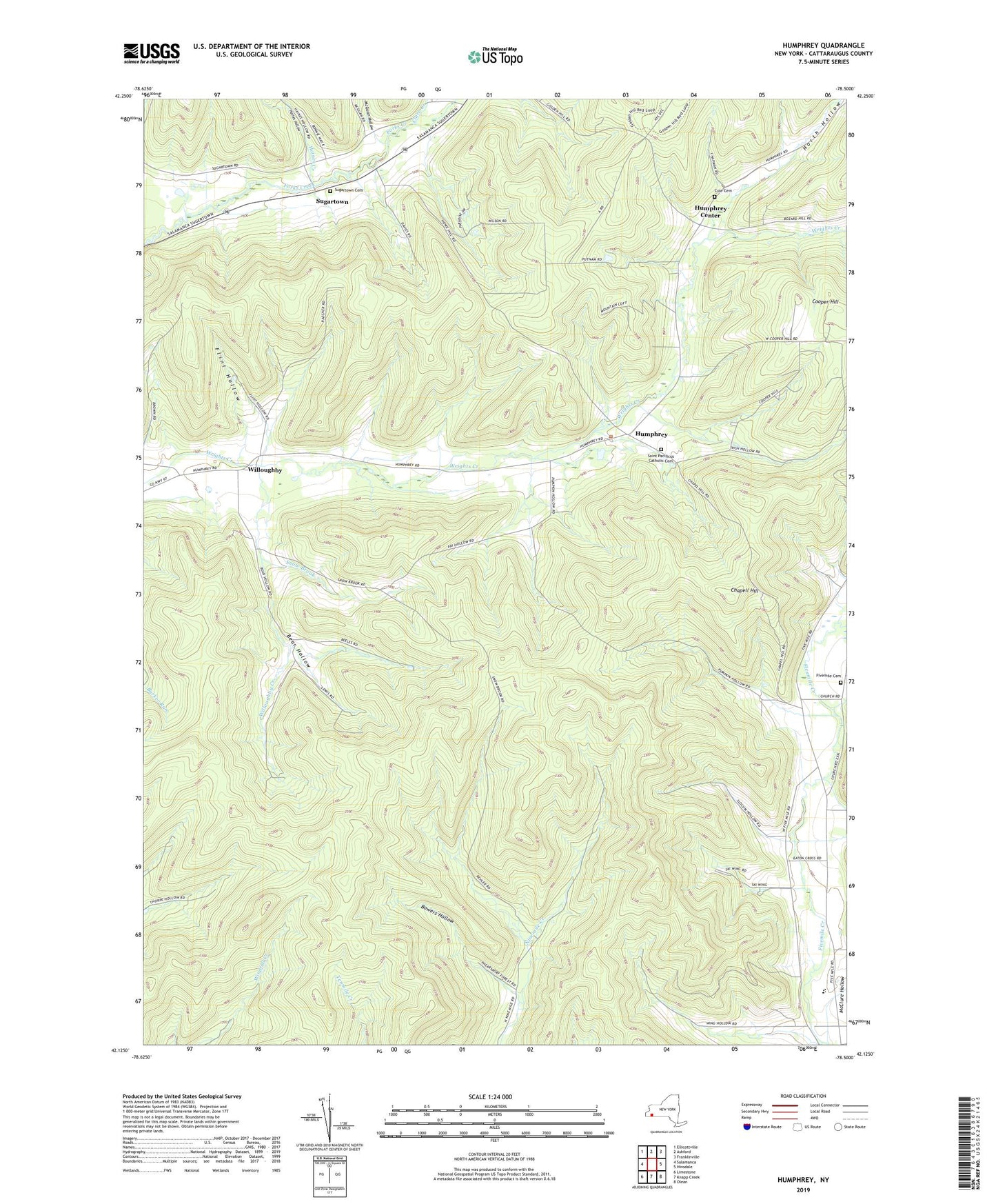
2019 topographic map quadrangle Humphrey in the state of New York. Scale: 1:24000. Based on the newly updated USGS 7.5' US Topo map series, this map is in the following counties: Cattaraugus. The map contains contour data, water features, and other items you are used to seeing on USGS maps, but also has updated roads and other features. This is the next generation of topographic maps. Printed on high-quality waterproof paper with UV fade-resistant inks.
Quads adjacent to this one:
West: Salamanca
Northwest: Ellicottville
North: Ashford
Northeast: Franklinville
East: Hinsdale
Southeast: Olean
South: Knapp Creek
Southwest: Limestone
Contains the following named places: Allegany - Limestone Middle School, Bear Hollow, Bowers Hollow, Chapell Hill, Clare Creek, Cole Cemetery, Cooper Hill, Five Mile Baptist Church, Fivemile Cemetery, Flint Hollow, Great Valley Berry Patch, Haines Creek, Haines Hollow, Humphrey, Humphrey Baptist Church, Humphrey Center, McGuan Hollow, Morgan Hollow, Mount Echo Bible Institute, North Hollow, Pumpkin Hollow, Saint Pacificus Catholic Cemetery, Saint Pacificus Church, Slocum Hollow, Snow Brook, Sugartown, Sugartown Cemetery, Town of Humphrey, Willoughby, Willoughby Creek, Wing Hollow, ZIP Code: 14741