MyTopo
Ashford New York US Topo Map
Couldn't load pickup availability
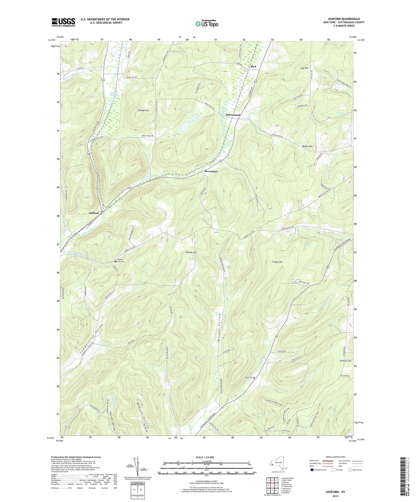
2023 topographic map quadrangle Ashford in the state of New York. Scale: 1:24000. Based on the newly updated USGS 7.5' US Topo map series, this map is in the following counties: Cattaraugus. The map contains contour data, water features, and other items you are used to seeing on USGS maps, but also has updated roads and other features. This is the next generation of topographic maps. Printed on high-quality waterproof paper with UV fade-resistant inks.
Quads adjacent to this one:
West: Ellicottville
Northwest: Ashford Hollow
North: West Valley
Northeast: Delevan
East: Franklinville
Southeast: Hinsdale
South: Humphrey
Southwest: Salamanca
This map covers the same area as the classic USGS quad with code o42078c5.
Contains the following named places: Ashford, Bakerstand, Beaver Meadows, Beaver Meadows Creek, Bird, Boyce Hill, Bryant Hill, Bryant Hill Cemetery, Bryant Hill Creek, Canada Hill, Crosby Hill, Devereaux, Devereaux Branch, Fancy Tract, Laidlaw Hill, Morgan Hollow, Root Cemetery, Sugartown Church, Tug Hill