MyTopo
Page Mountain New York US Topo Map
Couldn't load pickup availability
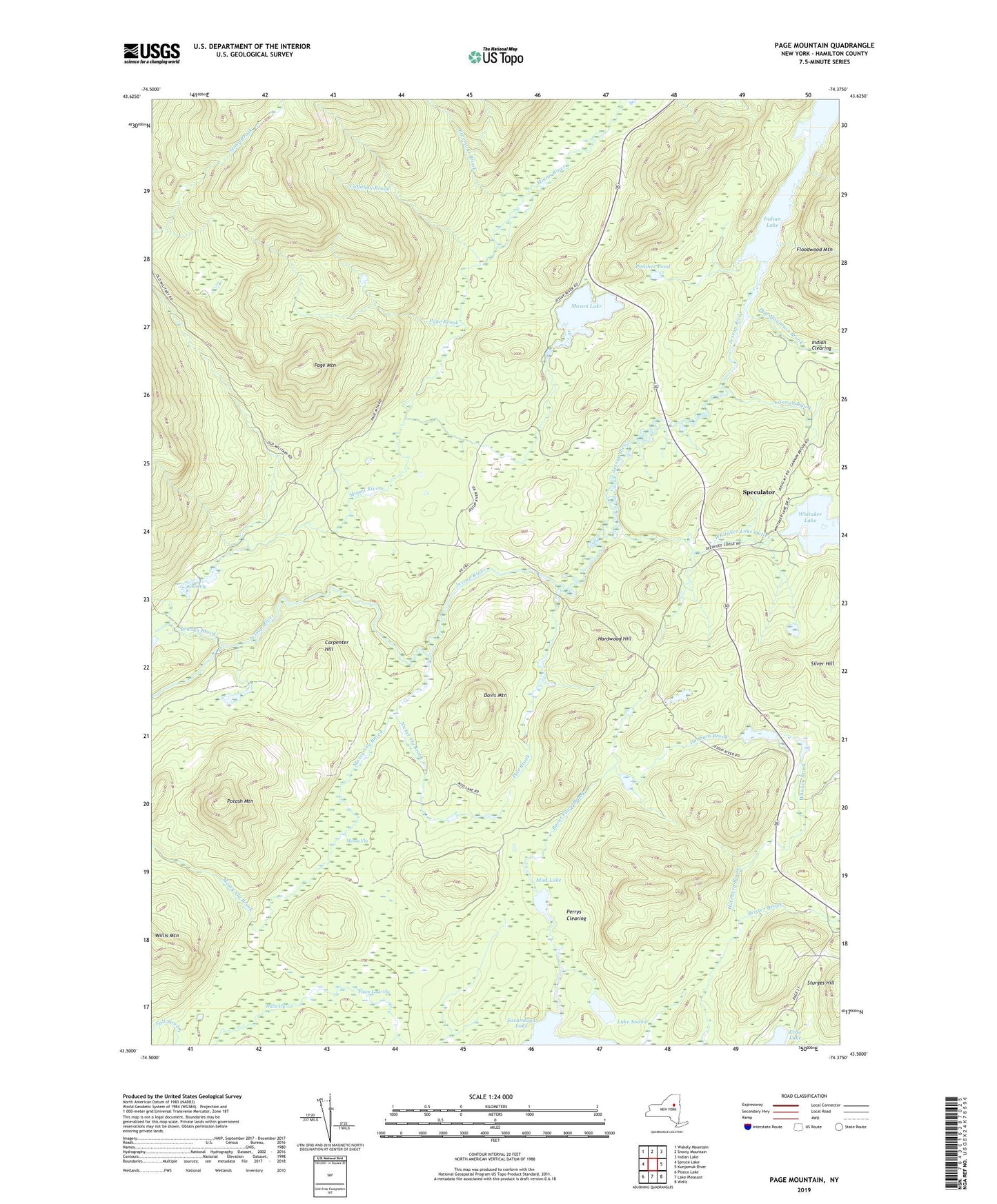
2023 topographic map quadrangle Page Mountain in the state of New York. Scale: 1:24000. Based on the newly updated USGS 7.5' US Topo map series, this map is in the following counties: Hamilton. The map contains contour data, water features, and other items you are used to seeing on USGS maps, but also has updated roads and other features. This is the next generation of topographic maps. Printed on high-quality waterproof paper with UV fade-resistant inks.
Quads adjacent to this one:
West: Spruce Lake
Northwest: Wakely Mountain
North: Snowy Mountain
Northeast: Indian Lake
East: Kunjamuk River
Southeast: Wells
South: Lake Pleasant
Southwest: Piseco Lake
This map covers the same area as the classic USGS quad with code k43074e3.
Contains the following named places: Bellin Vly, Bradys Brook, Brister Brook, Burnt Place Brook, Callahan Brook, Camp, Camp Number Nineteen, Camp Number Twenty-two, Cannon Brook, Carpenter Hill, Davis Mountain, Dug Mountain Brook, Dunham Brook, Fawn Lake Vly, Freemont Brook, Hardwood Hill, Indian Clearing, Jessup River, Lake Sound, Mason Lake, Miami River Leanto, Mossy Vly, Mossy Vly Brook, Mud Lake, Nickel Vly Brook, Page Brook, Page Mountain, Panther Pond, Perkins Clearing, Perrys Clearing, Pole Brook, Potash Mountain, Silver Hill, Sled Harbor, Sturges Hill, Town of Lake Pleasant, Whiskey Brook, Whitaker Lake Outlet, Willis Vly, ZIP Code: 12108