MyTopo
Johnsburg New York US Topo Map
Couldn't load pickup availability
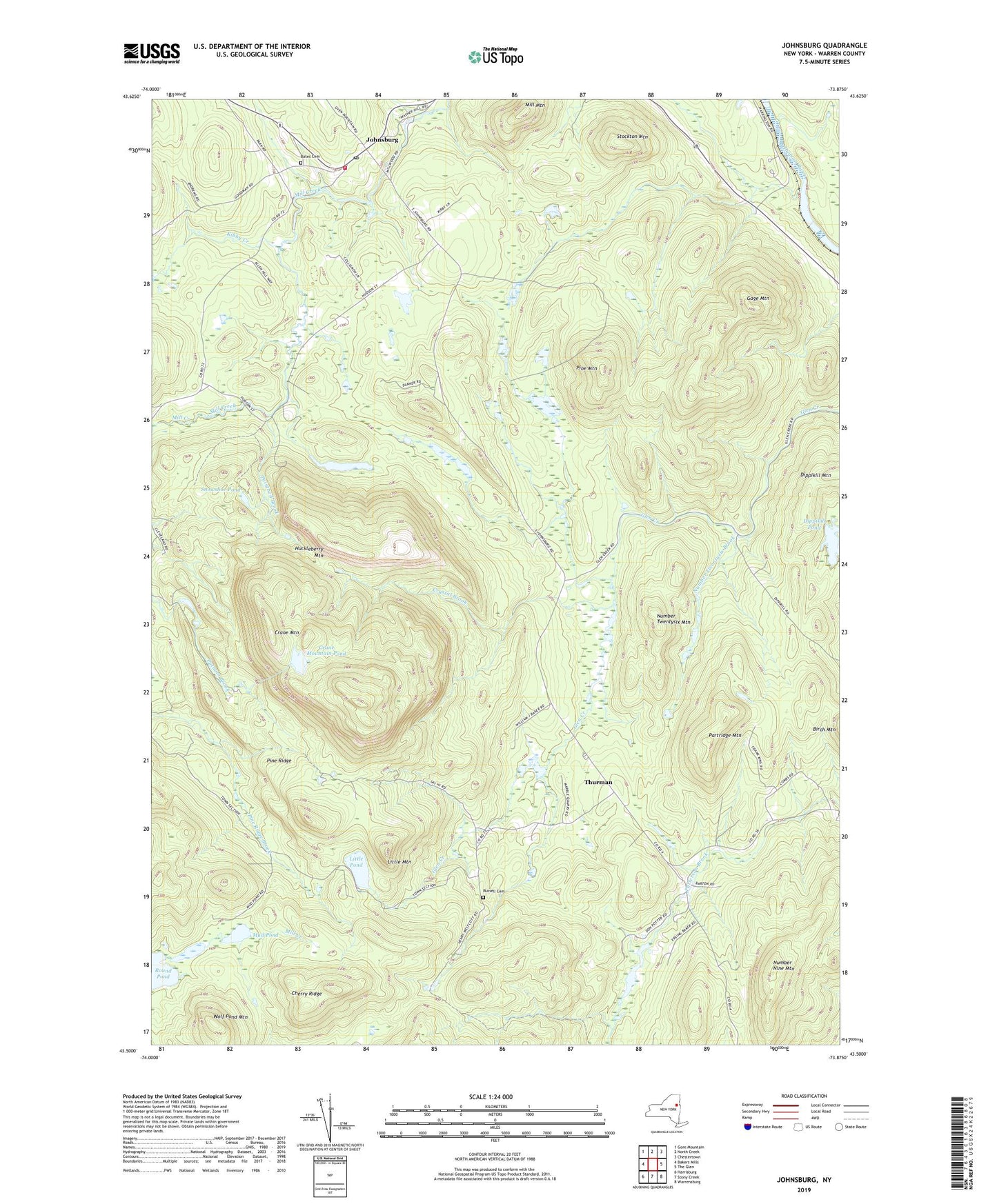
2019 topographic map quadrangle Johnsburg in the state of New York. Scale: 1:24000. Based on the newly updated USGS 7.5' US Topo map series, this map is in the following counties: Warren. The map contains contour data, water features, and other items you are used to seeing on USGS maps, but also has updated roads and other features. This is the next generation of topographic maps. Printed on high-quality waterproof paper with UV fade-resistant inks.
Quads adjacent to this one:
West: Bakers Mills
Northwest: Gore Mountain
North: North Creek
Northeast: Chestertown
East: The Glen
Southeast: Warrensburg
South: Stony Creek
Southwest: Harrisburg
Contains the following named places: Bates Cemetery, Camp Dippikill, Cherry Ridge, Crane Mountain, Crane Mountain Pond, Crystal Brook, Dippikill Pond, Gage Mountain, Gobbler's Knob Farm, Huckleberry Mountain, Johnsburg, Johnsburg Post Office, Johnsburg Volunteer Fire Department, Kibby Creek, Little Mountain, Little Pond, Mill Mountain, Mud Pond, Number Nine Mountain, Number Twentysix Brook, Number Twentysix Mountain, Paintbed Brook, Partridge Mountain, Pine Mountain, Pine Ridge, Russell Cemetery, Snowshoe Pond, Stockton Mountain, Thurman, Town of Thurman, Wolf Pond Mountain, ZIP Code: 12843