MyTopo
Gore Mountain New York US Topo Map
Couldn't load pickup availability
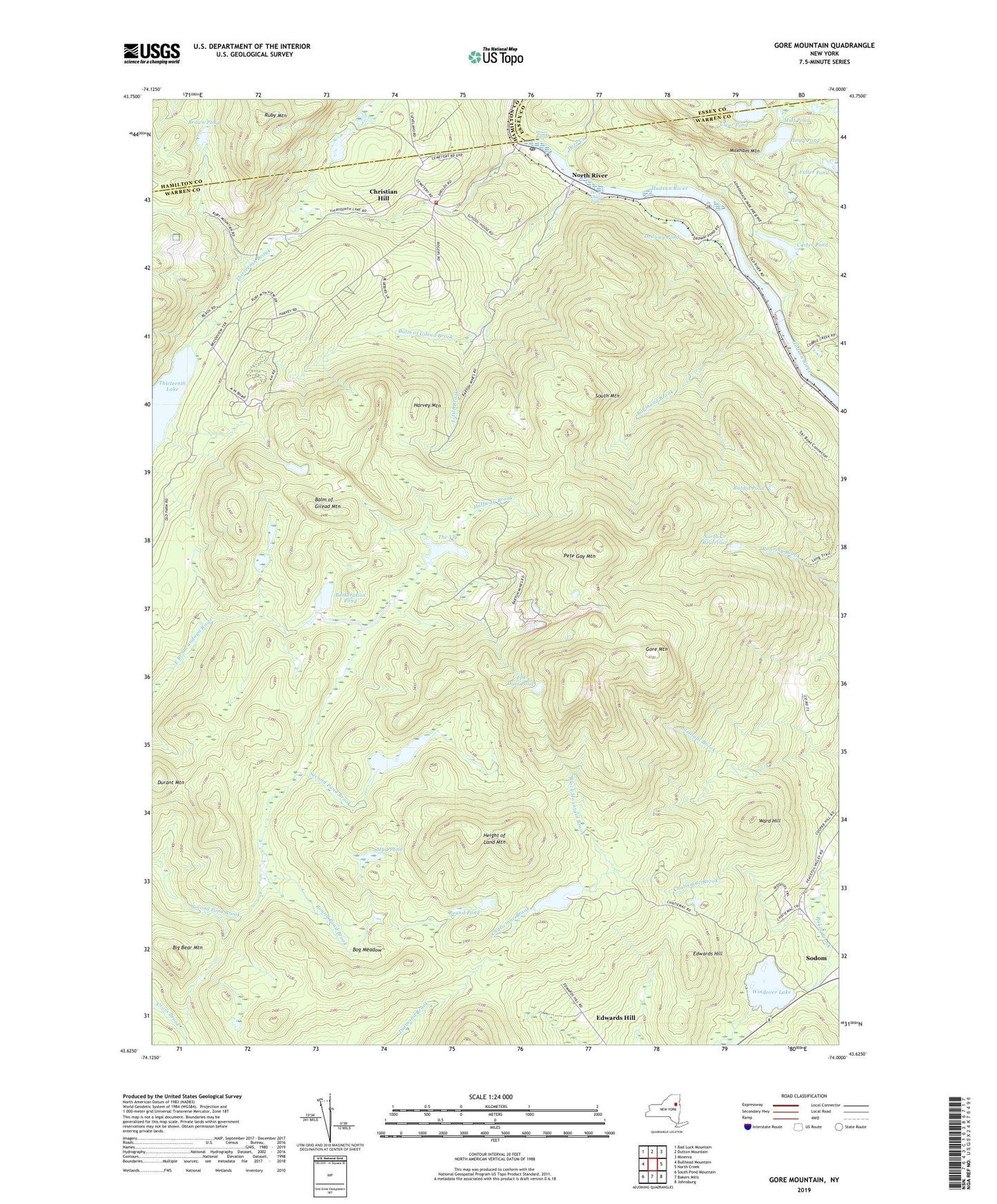
2023 topographic map quadrangle Gore Mountain in the state of New York. Scale: 1:24000. Based on the newly updated USGS 7.5' US Topo map series, this map is in the following counties: Warren, Hamilton, Essex. The map contains contour data, water features, and other items you are used to seeing on USGS maps, but also has updated roads and other features. This is the next generation of topographic maps. Printed on high-quality waterproof paper with UV fade-resistant inks.
Quads adjacent to this one:
West: Bullhead Mountain
Northwest: Bad Luck Mountain
North: Dutton Mountain
Northeast: Minerva
East: North Creek
Southeast: Johnsburg
South: Bakers Mills
Southwest: South Pond Mountain
Contains the following named places: Balm of Gilead Brook, Balm of Gilead Mountain, Bartons Mine, Big Bear Mountain, Black Mountain Brook, Bog Meadow, Botheration Pond, Brown Pond, Carter Pond, Chatiemac Brook, Chatiemac Lake, Christian Hill, Clear Pond, Deer Creek, District School Number 7, Durant Mountain, Edwards Hill, Gore Mountain, Halfway Brook, Harvey Mountain, Height of Land Mountain, Little Brook, Long Pond, Mouse Rapids, Mud Pond, North Creek Reservoir, North River, North River Fire Department, North River Post Office, Ordway Pond, Perry Ehlers Rapids, Pete Gay Mountain, Rabbit Pond, Raymond Brook, Round Pond, Round Pond Brook, Ruby Mountain, Second Pond, South Mountain, The Vly, Thirteenth Brook, Town of Johnsburg, Upper Dam Pond, Ward Hill, Windover Lake, ZIP Code: 12853