MyTopo
Jordanville New York US Topo Map
Couldn't load pickup availability
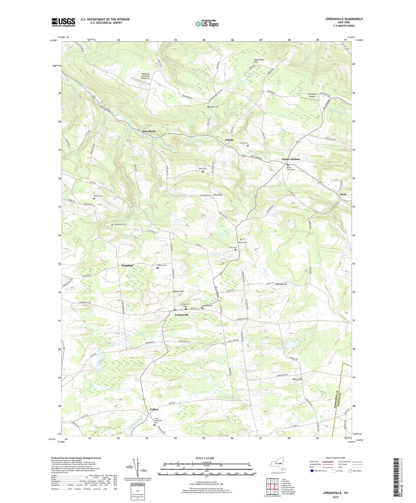
2023 topographic map quadrangle Jordanville in the state of New York. Scale: 1:24000. Based on the newly updated USGS 7.5' US Topo map series, this map is in the following counties: Herkimer, Otsego. The map contains contour data, water features, and other items you are used to seeing on USGS maps, but also has updated roads and other features. This is the next generation of topographic maps. Printed on high-quality waterproof paper with UV fade-resistant inks.
Quads adjacent to this one:
West: Millers Mills
Northwest: Ilion
North: Herkimer
Northeast: Little Falls
East: Van Hornesville
Southeast: East Springfield
South: Richfield Springs
Southwest: Schuyler Lake
This map covers the same area as the classic USGS quad with code o42074h8.
Contains the following named places: Brown Cemetery, Brown School, Crain Memorial Cemetery, Crains Corners, Crim Cemetery, Cullen, Day Creek, Days Rock, Deck, Edicks, Flat Creek, Harter Hill, Heath Cemetery, Helmer Cemetery, Henderson Cemetery, Highland Cemetery, Holy Trinity Monastery, Jordanville, Jordanville Cemetery, Jordanville Post Office, Jordanville Public Library, Kingdom, Land of Milk and Honey, Merry Hill, Mohawk Aviation Center LLC, Mud Lake, Murray Hill, Paine - Swift Cemetery, Paine Cemetery, Paines Hollow, Piper Cemetery, Pooler Cemetery, Rock Hill, School Number 5, School Number 6, School Number 9, Shoemaker Hill, Sky-Ranch Airport, Spring Lawn Farm, Town of German Flatts, Town of Warren, Wooly Hill Farm, WOWB-FM (Little Falls), ZIP Code: 13407