MyTopo
Sabattis New York US Topo Map
Couldn't load pickup availability
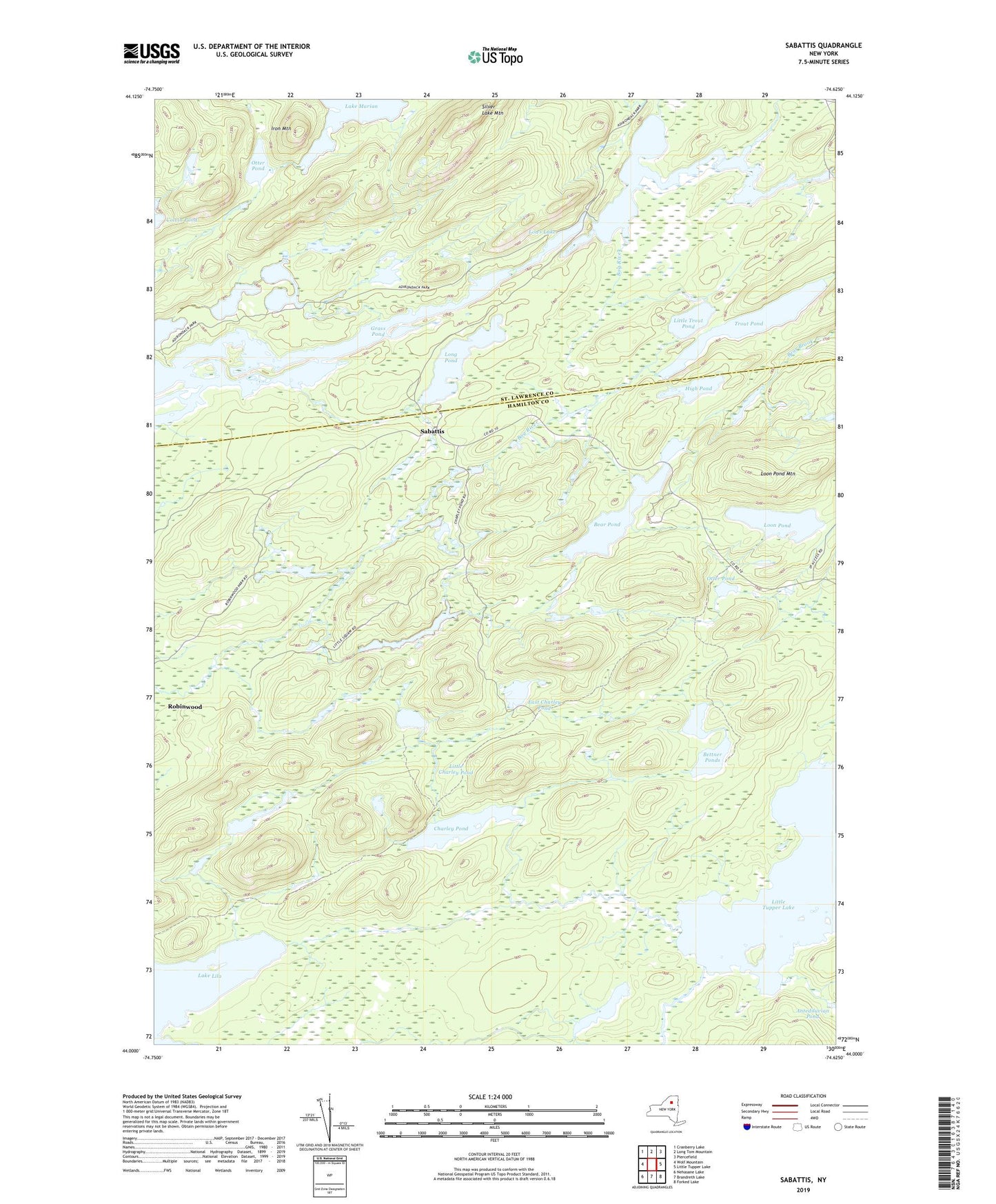
2023 topographic map quadrangle Sabattis in the state of New York. Scale: 1:24000. Based on the newly updated USGS 7.5' US Topo map series, this map is in the following counties: Hamilton, St. Lawrence. The map contains contour data, water features, and other items you are used to seeing on USGS maps, but also has updated roads and other features. This is the next generation of topographic maps. Printed on high-quality waterproof paper with UV fade-resistant inks.
Quads adjacent to this one:
West: Wolf Mountain
Northwest: Cranberry Lake
North: Long Tom Mountain
Northeast: Piercefield
East: Little Tupper Lake
Southeast: Forked Lake
South: Brandreth Lake
Southwest: Nehasane Lake
Contains the following named places: Bear Pond, Bettner Ponds, Bum Pond, Charley Pond, East Charley Pond, High Pond, Hitchins Pond, Hornet Ponds, Iron Mountain, Iron Pond, Lake Marian, Little Charley Pond, Little Trout Pond, Long Pond, Loon Pond, Loon Pond Mountain, Lows Lake, Otter Pond, Robinwood, Sabattis, Silver Lake Mountain, Spring Pond, Trout Pond