MyTopo
Middleburgh New York US Topo Map
Couldn't load pickup availability
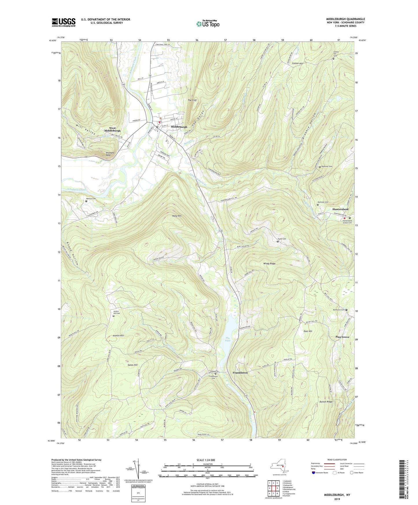
2023 topographic map quadrangle Middleburgh in the state of New York. Scale: 1:24000. Based on the newly updated USGS 7.5' US Topo map series, this map is in the following counties: Schoharie. The map contains contour data, water features, and other items you are used to seeing on USGS maps, but also has updated roads and other features. This is the next generation of topographic maps. Printed on high-quality waterproof paper with UV fade-resistant inks.
Quads adjacent to this one:
West: Breakabeen
Northwest: Cobleskill
North: Schoharie
Northeast: Gallupville
East: Rensselaerville
Southeast: Durham
South: Livingstonville
Southwest: Gilboa
This map covers the same area as the classic USGS quad with code o42074e3.
Contains the following named places: Armlin Hill, Armlin Hill Cemetery, Barkman Cemetery, Bohringers Fruit Farm, Borthwick Cemetery, Brookie Hollow, Cotton Hill Cemetery, Dutton Ridge, East Hill, East Hill Church, Franklinton, Franklinton Cemetery, Gates Hill, Gates Hill Church, Highwinds Farm, Hony Hill, Huntersland, Huntersland School Cemetery, Huntersland Volunteer Fire Department, Laughton Hollow, Line Creek, Little Schoharie Creek, Mattice Cemetery, Middleburgh, Middleburgh Central School, Middleburgh Elementary School, Middleburgh Emergency Volunteer Ambulance Corps, Middleburgh Fire Department, Middleburgh Library, Middleburgh Post Office, Mill Valley, Pilgrim Holiness Church, Pine Grove, Red Maple Farm, Reformed Church of Middleburgh, Saint Catherines Roman Catholic Church, Saint Mark's Christian School, Saint Mark's Lutheran Church, School Number 5, Stony Creek, Taylor Cemetery, The Cliff, The Gorge, The Vlaie, Town of Broome, Town of Middleburgh, Village of Middleburgh, Vromans Nose, West Middleburgh, Windy Ridge, ZIP Code: 12122