MyTopo
Margaretville New York US Topo Map
Couldn't load pickup availability
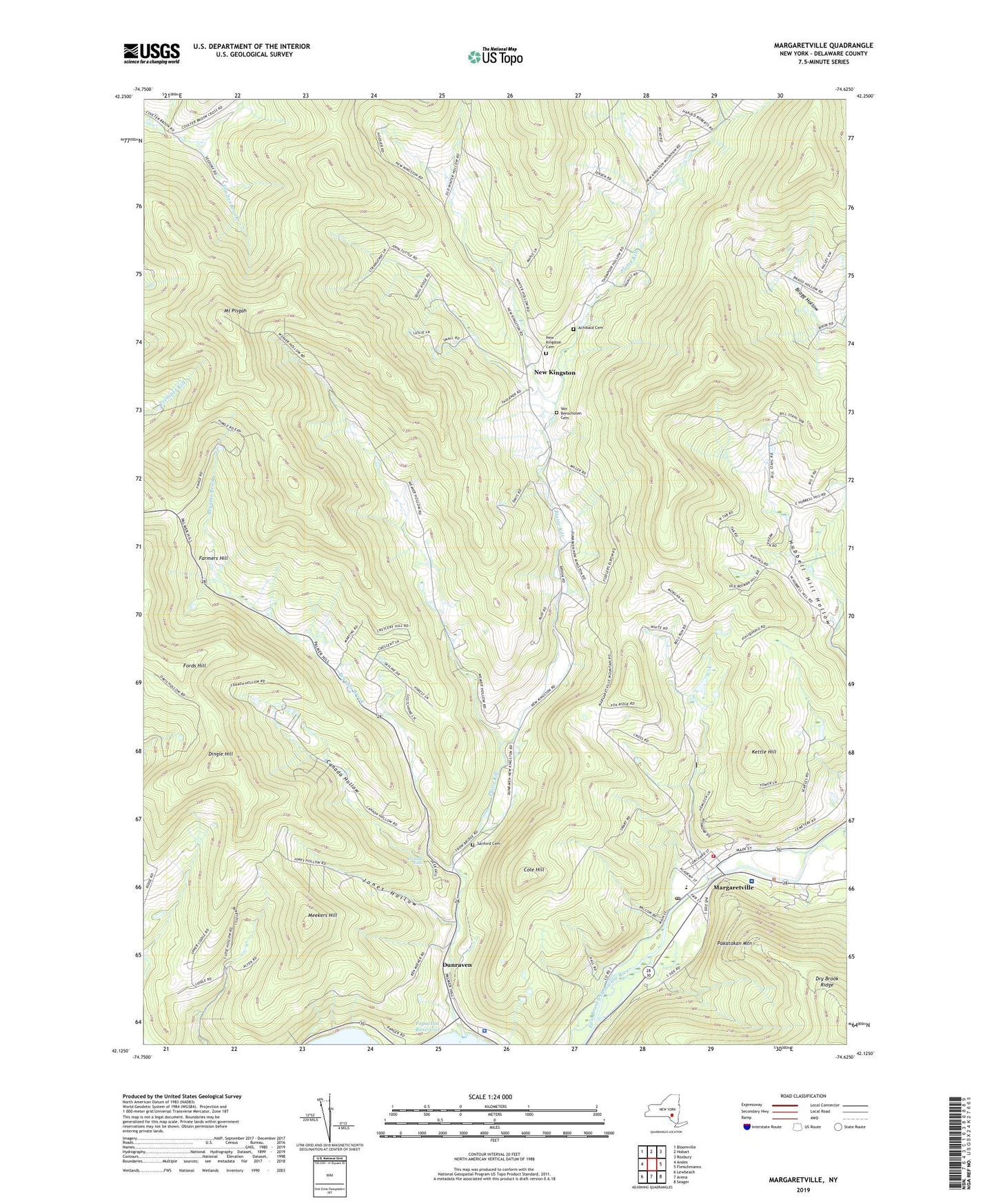
2019 topographic map quadrangle Margaretville in the state of New York. Scale: 1:24000. Based on the newly updated USGS 7.5' US Topo map series, this map is in the following counties: Delaware. The map contains contour data, water features, and other items you are used to seeing on USGS maps, but also has updated roads and other features. This is the next generation of topographic maps. Printed on high-quality waterproof paper with UV fade-resistant inks.
Quads adjacent to this one:
West: Andes
Northwest: Bloomville
North: Hobart
Northeast: Roxbury
East: Fleischmanns
Southeast: Seager
South: Arena
Southwest: Lewbeach
Contains the following named places: Achibald Cemetery, Bryants Brook, Canada Falls, Canada Hollow, Catskill Mountain Christian Center, Catskill Park, Cole Hill, Dingle Hill, Dry Brook, Dunraven, Elliott Homestead Landing Strip, Farmers Hill, Fords Hill, Galli Curci Theatre, Jones Hollow, Kettle Hill, Margaretville, Margaretville Central School, Margaretville Fire Department, Margaretville Hospital, Margaretville Post Office, Margaretville Sewer Treatment Plant, Margaretville United Methodist Church, Margaretville Village Hall, Meekers Hill, Mount Pisgah, Mountainside Residential Care Center, New Kingston, New Kingston Cemetery, Pakatakan Mountain, Palmer Hollow, Platte Kill, Sacred Heart Church, Saint Margaret's Episcopal Church, Sanford Cemetery, Sanford Hollow, Thompson Hollow, Town of Middletown, Van Benschoten Cemetery, Village of Margaretville, Weaver Hollow, Winter Hollow, ZIP Codes: 12455, 12459