MyTopo
Roxbury New York US Topo Map
Couldn't load pickup availability
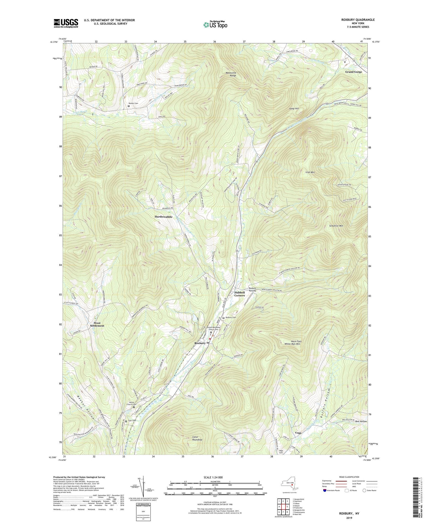
2023 topographic map quadrangle Roxbury in the state of New York. Scale: 1:24000. Based on the newly updated USGS 7.5' US Topo map series, this map is in the following counties: Delaware, Greene. The map contains contour data, water features, and other items you are used to seeing on USGS maps, but also has updated roads and other features. This is the next generation of topographic maps. Printed on high-quality waterproof paper with UV fade-resistant inks.
Quads adjacent to this one:
West: Hobart
Northwest: Harpersfield
North: Stamford
Northeast: Gilboa
East: Prattsville
Southeast: West Kill
South: Fleischmanns
Southwest: Margaretville
This map covers the same area as the classic USGS quad with code o42074c5.
Contains the following named places: Bed Hollow, Buffalo Hollow, Cator Roundtop, Decker Cemetery, Grand Gorge, Hack Flats, Hardscrabble, Hubbell Corners, Irish Mountain, Jay Gould Memorial Reformed Church, Jump Brook, Jump Hill, Moffit Settlement Hollow, Montgomery Hollow, More Settlement, Moresville Range, Pleasant Valley Brook, Roxbury, Roxbury Cemetery, Roxbury Central School, Roxbury Post Office, Roxbury Runway, Roxbury United Methodist Church, Roxbury Volunteer Fire Company, Schultice Mountain, Shephard Hills Golf Course, Stralton Falls Campground, Straton Falls, Town of Roxbury, Tyler Cemetery, United Methodist Church Cemetery, Vega, West Settlement, White Man Mountain, Yellow Church, Yellow Church Cemetery, ZIP Codes: 12421, 12434, 12474