MyTopo
Seager New York US Topo Map
Couldn't load pickup availability
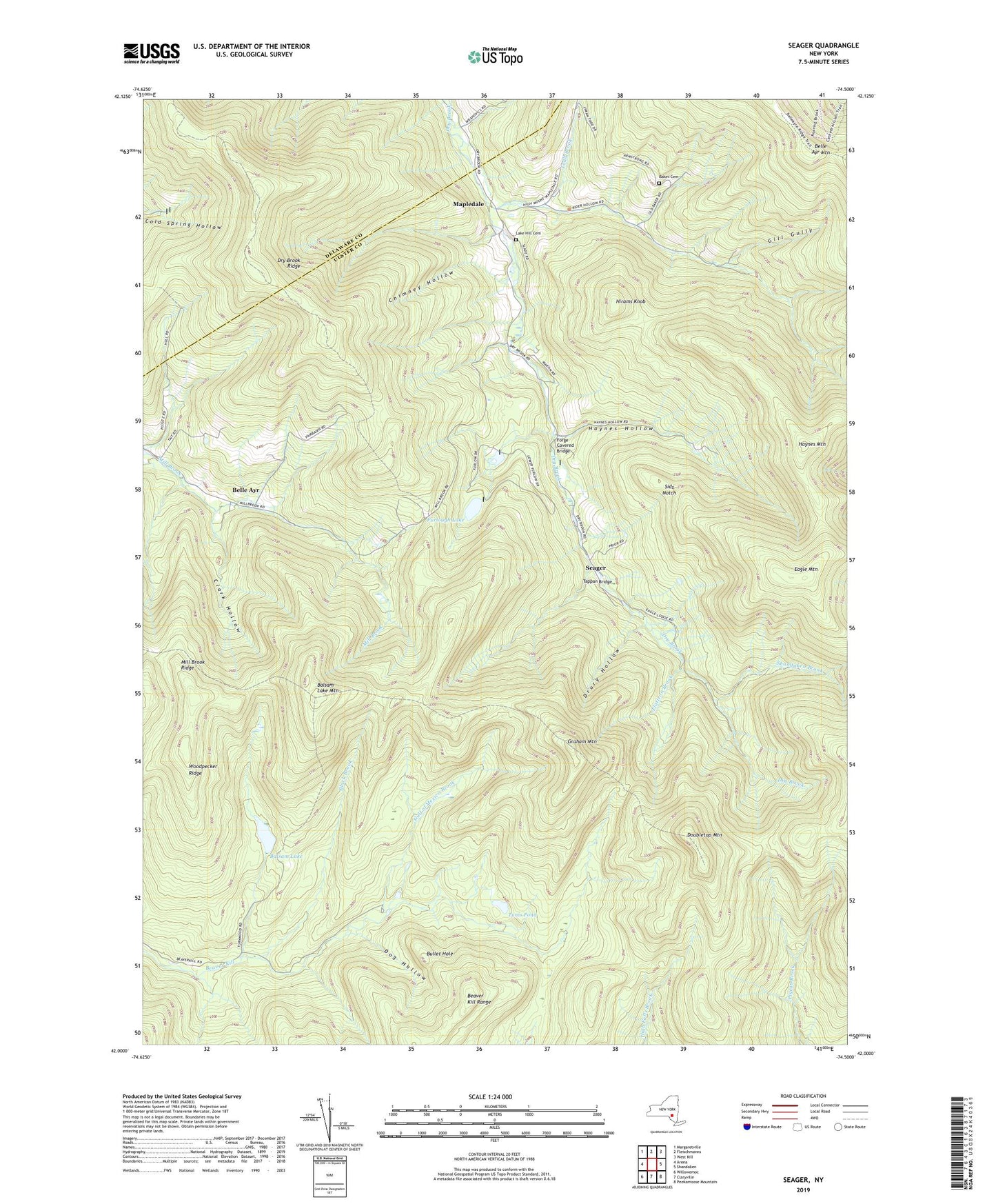
2023 topographic map quadrangle Seager in the state of New York. Scale: 1:24000. Based on the newly updated USGS 7.5' US Topo map series, this map is in the following counties: Ulster, Delaware. The map contains contour data, water features, and other items you are used to seeing on USGS maps, but also has updated roads and other features. This is the next generation of topographic maps. Printed on high-quality waterproof paper with UV fade-resistant inks.
Quads adjacent to this one:
West: Arena
Northwest: Margaretville
North: Fleischmanns
Northeast: West Kill
East: Shandaken
Southeast: Peekamoose Mountain
South: Claryville
Southwest: Willowemoc
This map covers the same area as the classic USGS quad with code o42074a5.
Contains the following named places: Baker Cemetery, Balsam Lake, Balsam Lake Mountain, Beaver Kill Range, Belle Ayr, Black Brook, Bullet Hole, Chimney Hollow, Clark Hollow, Dog Hollow, Doubletop Mountain, Drury Hollow, Dry Brook Ridge, Eagle Mountain, Flatiron Brook, Forge Covered Bridge, Furlough Lake, Gill Gully, Graham Mountain, Gulf of Mexico Brook, Haynes Hollow, Haynes Mountain, Hirams Knob, Lake Hill Cemetery, Mapledale, Mine Hollow, Number Ten Hollow, Quaker Cove, Rider Hollow, School Number 4, Seager, Shandaken Brook, Sids Notch, Tappan Bridge, Todd Brook, Tompkins Hollow, Town of Hardenburgh, Tunis Pond, Turner Hollow, Vly Pond, Woodpecker Ridge, Youngs Hollow, ZIP Code: 12406