MyTopo
Andes New York US Topo Map
Couldn't load pickup availability
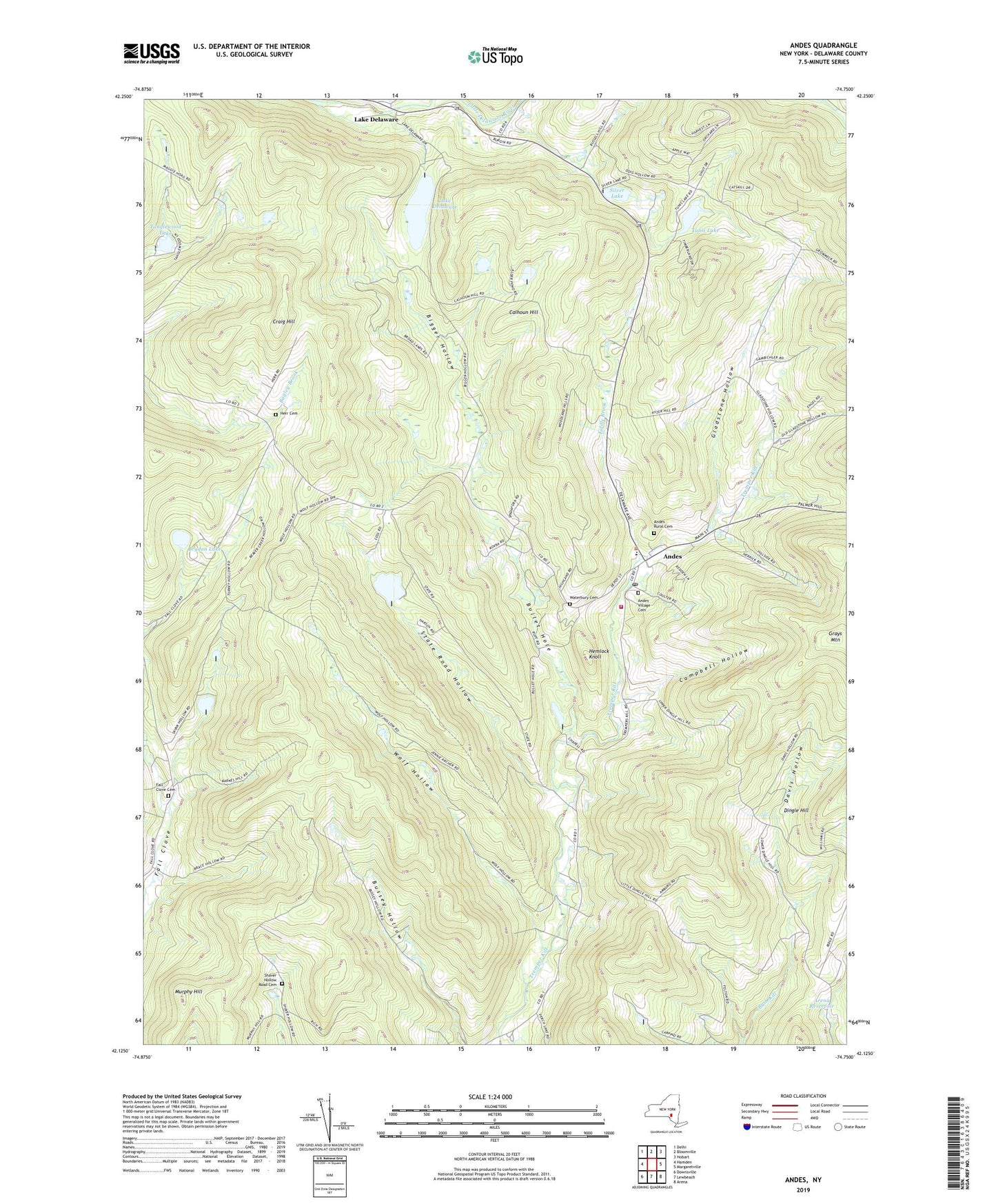
2023 topographic map quadrangle Andes in the state of New York. Scale: 1:24000. Based on the newly updated USGS 7.5' US Topo map series, this map is in the following counties: Delaware. The map contains contour data, water features, and other items you are used to seeing on USGS maps, but also has updated roads and other features. This is the next generation of topographic maps. Printed on high-quality waterproof paper with UV fade-resistant inks.
Quads adjacent to this one:
West: Hamden
Northwest: Delhi
North: Bloomville
Northeast: Hobart
East: Margaretville
Southeast: Arena
South: Lewbeach
Southwest: Downsville
This map covers the same area as the classic USGS quad with code o42074b7.
Contains the following named places: Andes, Andes Census Designated Place, Andes Central School, Andes Gap Filler Annex, Andes Post Office, Andes Presbyterian Church, Andes Rural Cemetery, Andes United Methodist Church, Andes Village Cemetery, Andes Volunteer Fire Department, Arena Reservoir, Bigger Hollow, Brydon Lake, Bullet Hole, Bush Creek Farm, Cabin Hill Church, Calhoun Hill, Campbell Hollow, Craig Hill, Davis Hollow, Fall Clove Cemetery, Gladstone Hollow, Grays Mountain, Hemlock Knoll, Hemlock Springs Farm, Herr Cemetery, Lake Delaware, Liddle Brook, Murphy Hill, Shaver Hollow Road Cemetery, Silver Lake, Skink Hollow, Skunk Hollow, State Road Hollow, Tanglewood Lake, Town of Andes, Tunis Lake, Tuttle Farm, Waterbury Cemetery, Wolf Hollow, ZIP Code: 13731