MyTopo
McKeever New York US Topo Map
Couldn't load pickup availability
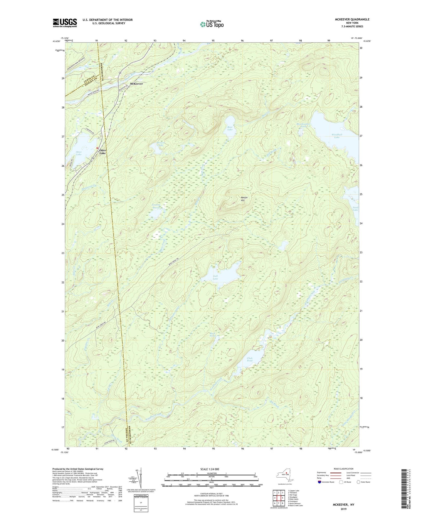
2019 topographic map quadrangle McKeever in the state of New York. Scale: 1:24000. Based on the newly updated USGS 7.5' US Topo map series, this map is in the following counties: Herkimer, Oneida, Lewis. The map contains contour data, water features, and other items you are used to seeing on USGS maps, but also has updated roads and other features. This is the next generation of topographic maps. Printed on high-quality waterproof paper with UV fade-resistant inks.
Quads adjacent to this one:
West: Woodgate
Northwest: Copper Lake
North: Thendara
Northeast: Old Forge
East: Bisby Lakes
Southeast: Black Creek Lake
South: North Wilmurt
Southwest: Forestport
Contains the following named places: Bear Lake, Big Brook, Bloodsucker Pond, Brewer Lake, Buck Pond, Chub Pond, Coleman Dam, Granny Marsh, Grindstone Creek, Gull Lake, Gull Lake Outlet, Lot 8 Creek, McKeever, Middle Branch Moose River, Mill Brook, Neejer Hill, Otter Lake, Otter Lake Census Designated Place, Otter Lake Fire Department, South Branch Moose River, Squirrel Ponds, Stony Brook, Wolf Lake Landing