MyTopo
Bisby Lakes New York US Topo Map
Couldn't load pickup availability
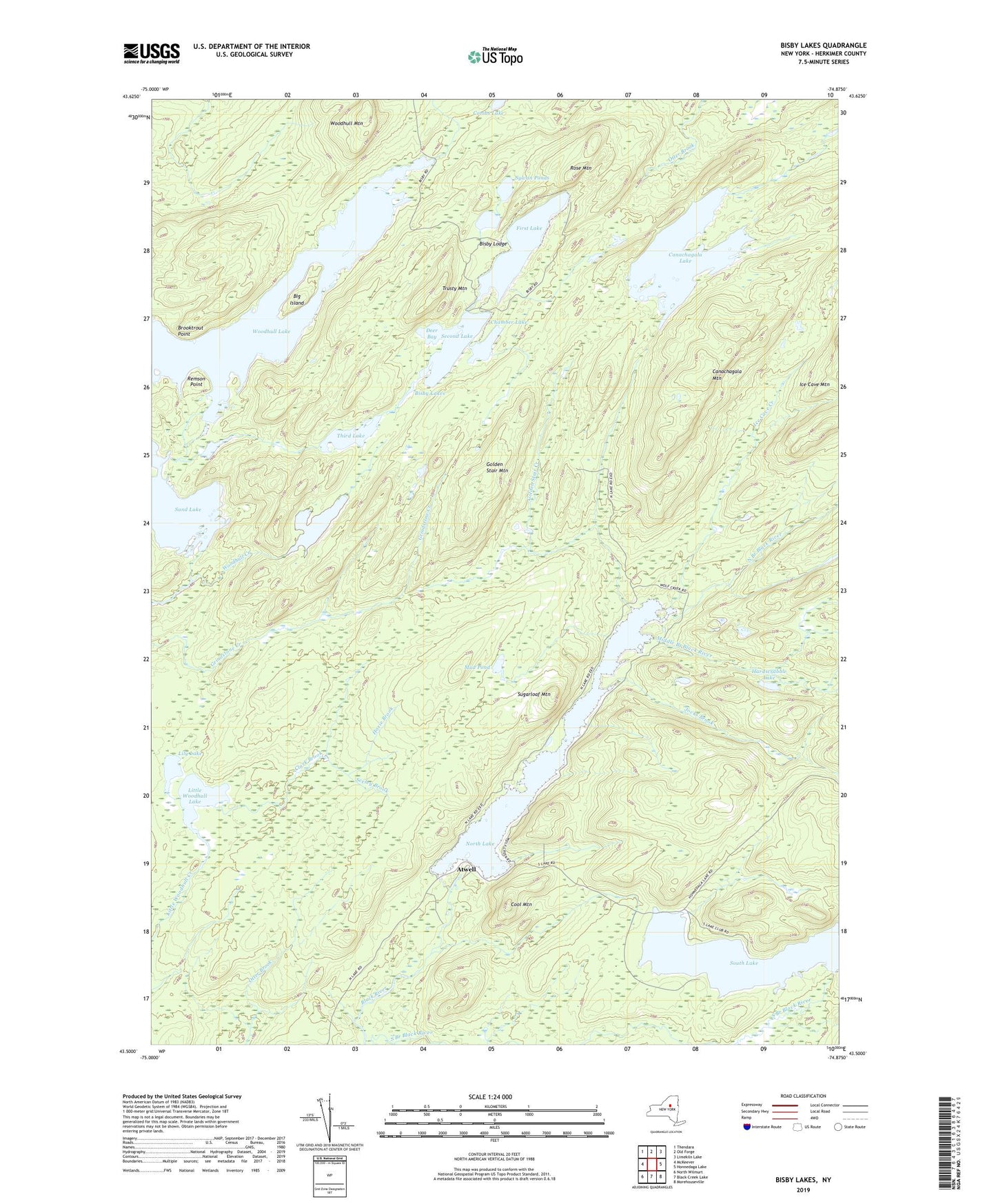
2023 topographic map quadrangle Bisby Lakes in the state of New York. Scale: 1:24000. Based on the newly updated USGS 7.5' US Topo map series, this map is in the following counties: Herkimer. The map contains contour data, water features, and other items you are used to seeing on USGS maps, but also has updated roads and other features. This is the next generation of topographic maps. Printed on high-quality waterproof paper with UV fade-resistant inks.
Quads adjacent to this one:
West: McKeever
Northwest: Thendara
North: Old Forge
Northeast: Limekiln Lake
East: Honnedaga Lake
Southeast: Morehouseville
South: Black Creek Lake
Southwest: North Wilmurt
Contains the following named places: Atwell, Big Island, Bisby Lakes, Bisby Lodge, Brooktrout Point, Canachagala Lake, Canachagala Mountain, Chamber Lake, Clark Brook, Combs Lake, Cool Mountain, Deer Bay, First Lake, Fourth Lake, Golden Stair Creek, Golden Stair Mountain, Hardscrabble Lake, Hoxie Brook, Ice Cave Creek, Ice Cave Valley, Jocks Brook, Lily Lake, Little Salmon Outlet, Little Woodhull Lake, Middle Branch Black River, Mud Pond, Nelson Brook, North Branch Black River, North Lake, Remson Point, Rose Mountain, Sand Lake, Second Lake, Seeley Brook, South Branch Black River, South Lake, Sugarloaf Mountain, Sylvan Ponds, Third Lake, Trusty Mountain, Woodhull Lake, Woodhull Mountain, ZIP Code: 13338