MyTopo
Middleville New York US Topo Map
Couldn't load pickup availability
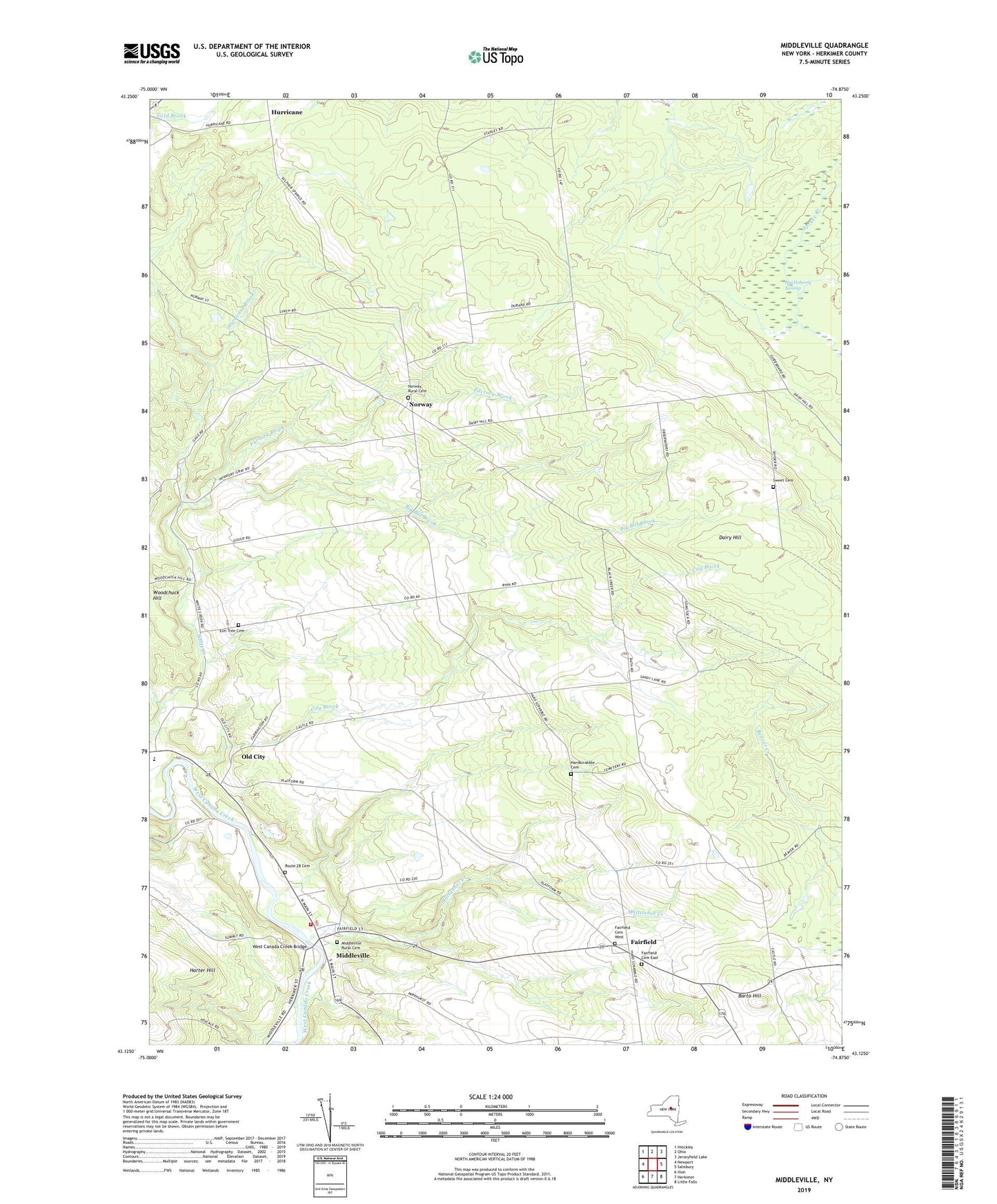
2019 topographic map quadrangle Middleville in the state of New York. Scale: 1:24000. Based on the newly updated USGS 7.5' US Topo map series, this map is in the following counties: Herkimer. The map contains contour data, water features, and other items you are used to seeing on USGS maps, but also has updated roads and other features. This is the next generation of topographic maps. Printed on high-quality waterproof paper with UV fade-resistant inks.
Quads adjacent to this one:
West: Newport
Northwest: Hinckley
North: Ohio
Northeast: Jerseyfield Lake
East: Salisbury
Southeast: Little Falls
South: Herkimer
Southwest: Ilion
Contains the following named places: Barto Hill, Big Bill Brook, Black Creek School, Dairy Hill, Dairy Hill School, Elm Tree Cemetery, Factory Brook, Fairfield, Fairfield Cemetery East, Fairfield Cemetery West, Hardscrabble Cemetery, Huckleberry Swamp, Hurricane, Hurricane Brook, Maltanner Creek, Middleville, Middleville Fire Department E W Corey Hose Company, Middleville Post Office, Middleville Rest Home, Middleville Rural Cemetery, Norway, Norway Rural Cemetery, Old City, Route 28 Cemetery, School Number 2, School Number 7, Sweet Cemetery, Town of Fairfield, Town of Norway, Village of Middleville, Welch Corners, West Canada Creek Bridge, West Canada Valley Junior - Senior High School, Wolf Hollow Creek, Woodchuck Hill, ZIP Codes: 13406, 13416