MyTopo
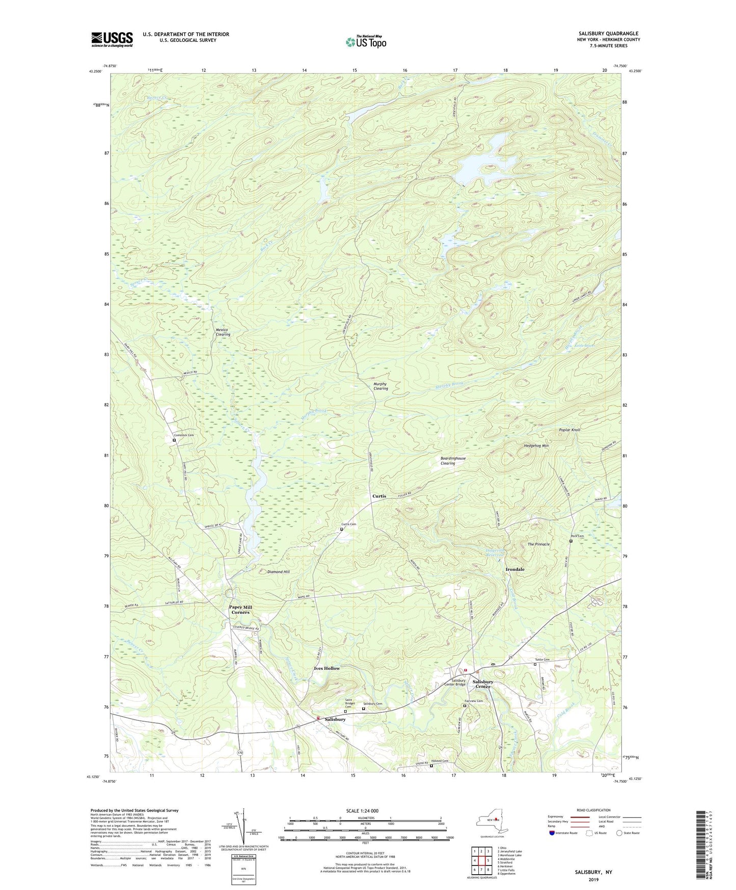
Salisbury New York US Topo Map
Couldn't load pickup availability
2023 topographic map quadrangle Salisbury in the state of New York. Scale: 1:24000. Based on the newly updated USGS 7.5' US Topo map series, this map is in the following counties: Herkimer. The map contains contour data, water features, and other items you are used to seeing on USGS maps, but also has updated roads and other features. This is the next generation of topographic maps. Printed on high-quality waterproof paper with UV fade-resistant inks.
Quads adjacent to this one:
West: Middleville
Northwest: Ohio
North: Jerseyfield Lake
Northeast: Morehouse Lake
East: Stratford
Southeast: Oppenheim
South: Little Falls
Southwest: Herkimer
This map covers the same area as the classic USGS quad with code o43074b7.
Contains the following named places: Beaver Creek, Boardinghouse Clearing, Buck Creek, Burrell Corners, Comstock Cemetery, Curtis, Curtis Cemetery, Diamond Hill, Dolgeville Reservoir, Fairview Cemetery, Fairview Corners, Hedgehog Mountain, Holsted Cemetery, Irondale, Ives Hollow, Kelly School, Kettle Beaver, Kirby Free Library of Salisbury, Klondike Reservoir, Mexico Clearing, Murphy Brook, Murphy Clearing, Paper Mill Corners, Peck Cemetery, Pine Crest Sanatorium, Poplar Knoll, Saint Bridget Cemetery, Salisbury, Salisbury Cemetery, Salisbury Center, Salisbury Center Bridge, Salisbury Center Census Designated Place, Salisbury Center Post Office, Salisbury Volunteer Fire Department Station 1, Salisbury Volunteer Fire Department Station 2, School Number 1, Spruce Lake, The Pinnacle, Town of Salisbury, Tuttle Cemetery, Wood Corners, ZIP Codes: 13365, 13454