MyTopo
Milford New York US Topo Map
Couldn't load pickup availability
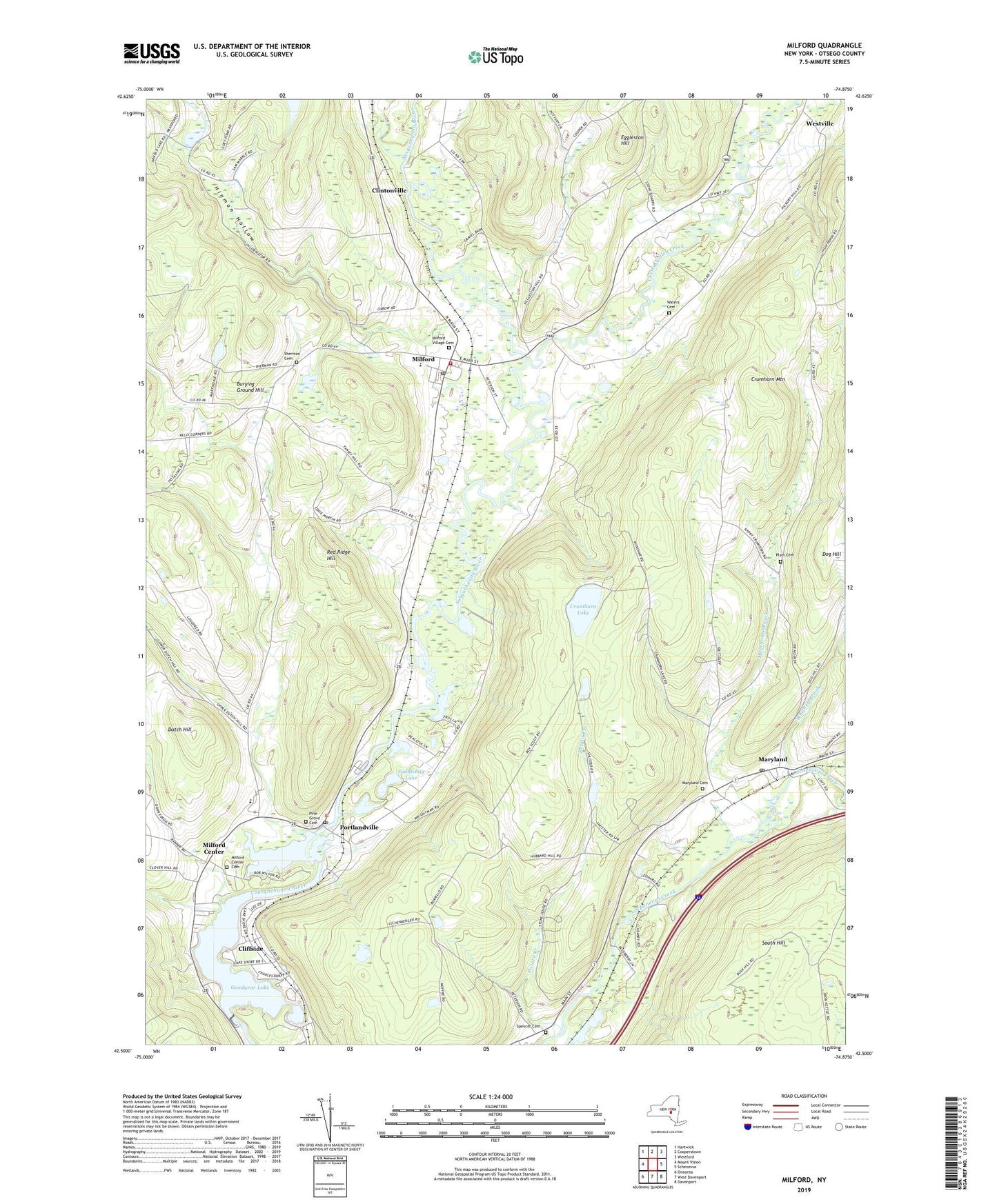
2019 topographic map quadrangle Milford in the state of New York. Scale: 1:24000. Based on the newly updated USGS 7.5' US Topo map series, this map is in the following counties: Otsego. The map contains contour data, water features, and other items you are used to seeing on USGS maps, but also has updated roads and other features. This is the next generation of topographic maps. Printed on high-quality waterproof paper with UV fade-resistant inks.
Quads adjacent to this one:
West: Mount Vision
Northwest: Hartwick
North: Cooperstown
Northeast: Westford
East: Schenevus
Southeast: Davenport
South: West Davenport
Southwest: Oneonta
Contains the following named places: Burying Ground Hill, Cherry Valley, Cherry Valley Creek, Cliffside, Clintonville, Crumhorn Lake, Crumhorn Mountain, Dutch Hill, Edson Corners, Eggleston Hill, Goodyear Lake, Hinman Hollow, Jamaica Dream Farm, Maryland, Maryland Baptist Church, Maryland Cemetery, Maryland Post Office, Milford, Milford Center, Milford Center Cemetery, Milford Central School, Milford Fire Department, Milford Free Library, Milford Post Office, Milford United Methodist Church, Milford Village Cemetery, Morehouse Brook, Pine Grove Cemetery, Platt Cemetery, Platt Hollow, Portlandville, Portlandville Census Designated Place, Portlandville Post Office, Potato Creek, Red Ridge Hill, Saddlebag Lake, School Number 2, School Number 3, School Number 4, Sherman Cemetery, Spencer Cemetery, Spring Brook, Town of Milford, Village of Milford, Waters Cemetery, Whitney Brook, ZIP Codes: 12116, 13807, 13834