MyTopo
Cooperstown New York US Topo Map
Couldn't load pickup availability
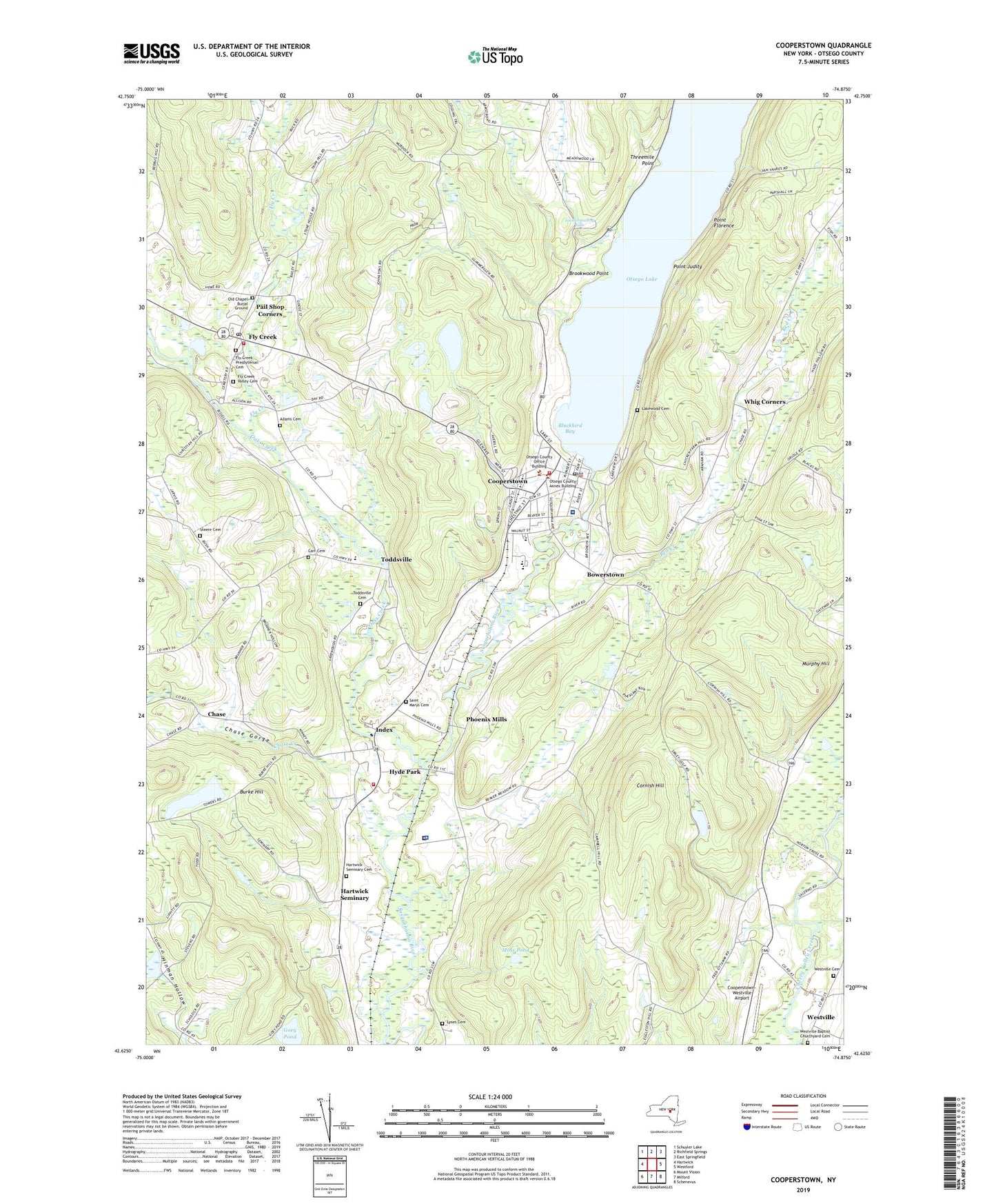
2023 topographic map quadrangle Cooperstown in the state of New York. Scale: 1:24000. Based on the newly updated USGS 7.5' US Topo map series, this map is in the following counties: Otsego. The map contains contour data, water features, and other items you are used to seeing on USGS maps, but also has updated roads and other features. This is the next generation of topographic maps. Printed on high-quality waterproof paper with UV fade-resistant inks.
Quads adjacent to this one:
West: Hartwick
Northwest: Schuyler Lake
North: Richfield Springs
Northeast: East Springfield
East: Westford
Southeast: Schenevus
South: Milford
Southwest: Mount Vision
This map covers the same area as the classic USGS quad with code o42074f8.
Contains the following named places: Adams Cemetery, Alfred Corning Clark Gymnasium, Bassett Medical Center, Black Brook, Blackbird Bay, Bowerstown, Brookwood Point, Burditt Brook, Burke Hill, Carr Cemetery, Chase, Chase Creek, Chase Gorge, Christ Episcopal Church, Church of the Messiah, Clara Welch Thanksgiving Home Assisted Living Center, Cooper Grounds Park, Cooperstown, Cooperstown Beaver Valley Campground, Cooperstown Elementary School, Cooperstown Fire Department, Cooperstown Indian Museum, Cooperstown Middle-Senior High School, Cooperstown Post Office, Cooperstown Village Hall, Cooperstown Village Sewage Treatment Plant, Cooperstown-Westville Airport, Cornish Hill, Deerslayer Goat Farm, Doubleday Field, First Baptist Church, First Methodist Episcopal Church, Fly Creek, Fly Creek Census Designated Place, Fly Creek Cider Mill and Orchard, Fly Creek Post Office, Fly Creek Presbyterian Cemetery, Fly Creek Valley Cemetery, Fly Creek Volunteer Fire Company, Forget-Me-Not Farm, Gardner Cemetery, Goey Pond, Hartwick Fire Department Company 2, Hartwick Highlands Campground, Hartwick Seminary, Hartwick Seminary Cemetery, Hartwick Seminary Census Designated Place, Hyde Park, Index, Iroquois Farm, Kingfisher Tower, Knox School, Lakewood Cemetery, Leatherstocking Creek, Leatherstocking Falls, Leatherstocking Golf Course, Lynes Cemetery, Moe Pond, Moss Pond, Murphy Hill, National Baseball Hall of Fame and Museum, Oaks Creek, Old Chapel Burial Ground, O-te-sa-ga Electric Light And Heating Plant, Otsego County Clerk's Office, Otsego County Court House, Otsego County Jail, Pail Shop Corners, Phoenix Mills, Point Florence, Point Judith, Red Creek, Saint Christina School, Saint Marys Cemetery, Saint Mary's Roman Catholic Church, School Number 1, School Number 12, School Number 16, School Number 2, School Number 3, School Number 5, School Number 6, School Number 7, Steere Cemetery, Sunny Slope Farm, The Brookwood School, Threemile Point, Toddsville, Toddsville Cemetery, Town of Otsego, Village Library of Cooperstown, Village of Cooperstown, Westville, Westville Baptist Churchyard Cemetery, Westville Cemetery, Whig Corners, Willow Brook, Woodside Hall Assisted Living Center, ZIP Code: 13326