MyTopo
Hartwick New York US Topo Map
Couldn't load pickup availability
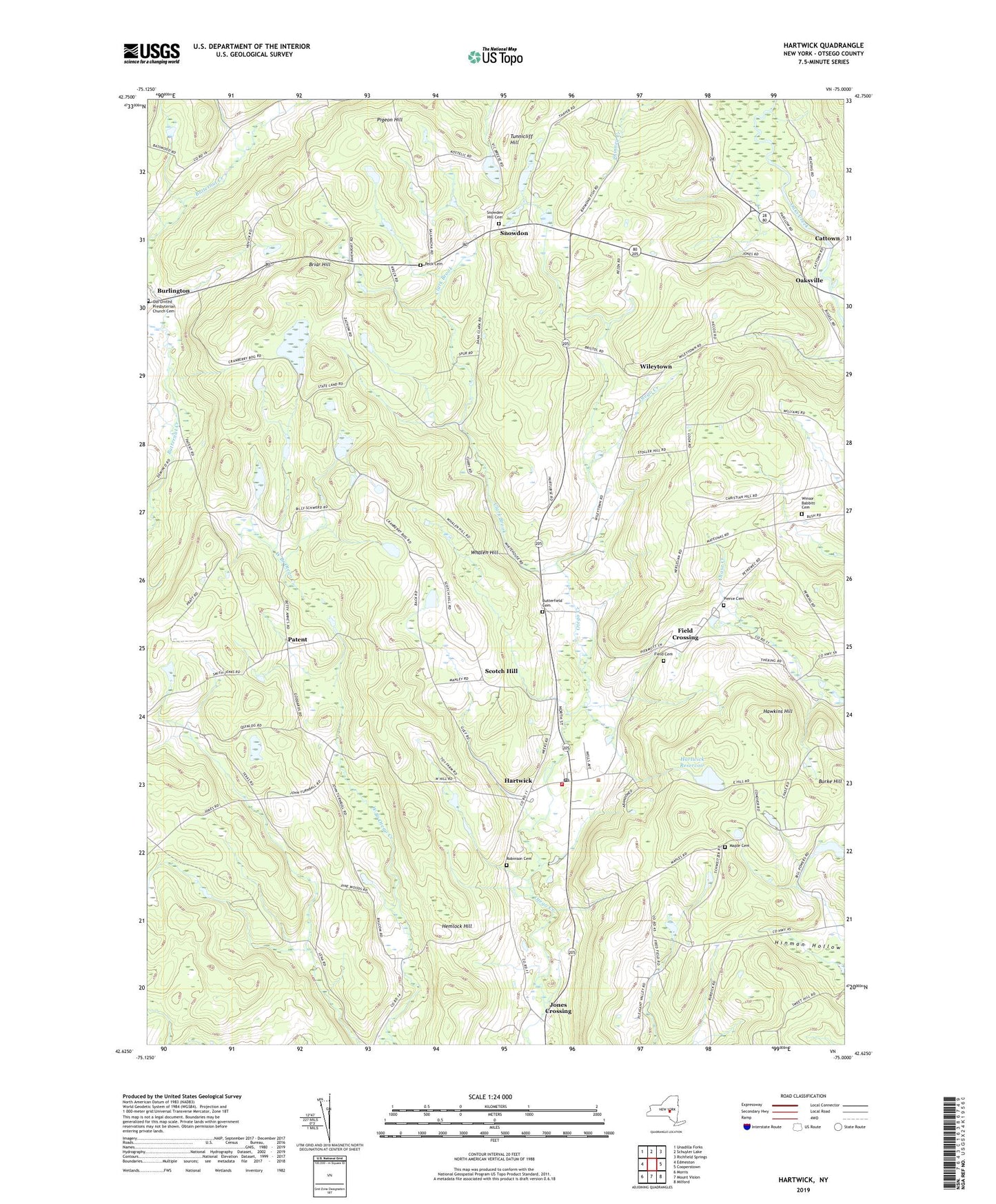
2023 topographic map quadrangle Hartwick in the state of New York. Scale: 1:24000. Based on the newly updated USGS 7.5' US Topo map series, this map is in the following counties: Otsego. The map contains contour data, water features, and other items you are used to seeing on USGS maps, but also has updated roads and other features. This is the next generation of topographic maps. Printed on high-quality waterproof paper with UV fade-resistant inks.
Quads adjacent to this one:
West: Edmeston
Northwest: Unadilla Forks
North: Schuyler Lake
Northeast: Richfield Springs
East: Cooperstown
Southeast: Milford
South: Mount Vision
Southwest: Morris
This map covers the same area as the classic USGS quad with code o42075f1.
Contains the following named places: Briar Hill, Briar Hill School, Butterfield Cemetery, Cattown, Clark Brook, Cooperstown Assembly of God, Cooperstown Family Campground, Cranberry Bog, Field Cemetery, Field Crossing, Hartwick, Hartwick Census Designated Place, Hartwick Fire Department Company 1, Hartwick Heights Mobile Home Park, Hartwick Post Office, Hartwick Reservoir, Hawkins Hill, Hemlock Hill, Jones Crossing, Maple Cemetery, Oaksville, Old United Presbyterian Church Cemetery, Otsego County, Paige Mobile Home Park, Patent, Peck Cemetery, Perkins Crossing, Pierce Cemetery, Pigeon Hill, Potter School, Robinson Cemetery, School Number 13, School Number 17, School Number 4, School Number 5, School Number 6, School Number 8, Scotch Hill, Snowden Hill Cemetery, Snowdon, Stevens Corners, Summit Crossing, Texas School, Town of Hartwick, Tunnicliff Hill, Whalen Hill, Whitehouse School, Wileytown, Winsor Babbitt Cemetery, ZIP Code: 13348