MyTopo
Minerva New York US Topo Map
Couldn't load pickup availability
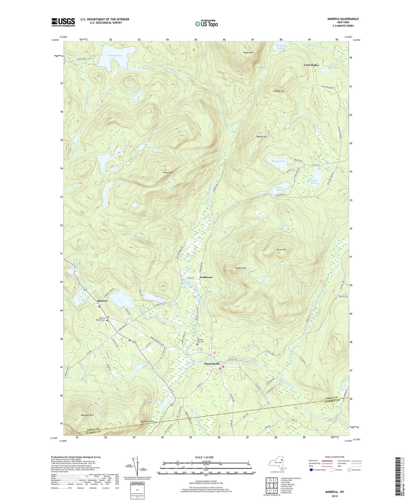
2019 topographic map quadrangle Minerva in the state of New York. Scale: 1:24000. Based on the newly updated USGS 7.5' US Topo map series, this map is in the following counties: Essex, Warren. The map contains contour data, water features, and other items you are used to seeing on USGS maps, but also has updated roads and other features. This is the next generation of topographic maps. Printed on high-quality waterproof paper with UV fade-resistant inks.
Quads adjacent to this one:
West: Dutton Mountain
Northwest: Vanderwhacker Mountain
North: Cheney Pond
Northeast: Blue Ridge
East: Schroon Lake
Southeast: Chestertown
South: North Creek
Southwest: Gore Mountain
Contains the following named places: Alder Brook, Bailey Pond, Barnes Pond, Big Sherman Pond, Bigsby Hill, Bigsby Pond, Calahan Pond, Center Pond, Cobble Hill, Duck Pond, Falls Brook, Federal Flat Cemetery, Grace Bible Fellowship, Green Mountain, Hayes Mountain, Hewitt Pond, Hewitt Pond Brook, Irishtown, Jones Brook, Kelso Brook, Little Sherman Pond, Loch Muller, Lost Pond, Minerva, Minerva Baptist Cemetery, Minerva Lake, Minerva Post Office, Minerva Stream, Minerva Volunteer Fire Department Station 1, Minerva Volunteer Fire Department Station 2, Moxham Mountain, Moxham Point, Moxham Pond, Muller Pond, North Branch Trout Brook, Oliver Hill, Oliver Pond, Olmstedville, Olmstedville Post Office, Ryan Brook, Saint Josephs Catholic Church, Saint Marys Church, Snyder Hill, Stony Pond, Warrens Pond, ZIP Code: 12857