MyTopo
Dutton Mountain New York US Topo Map
Couldn't load pickup availability
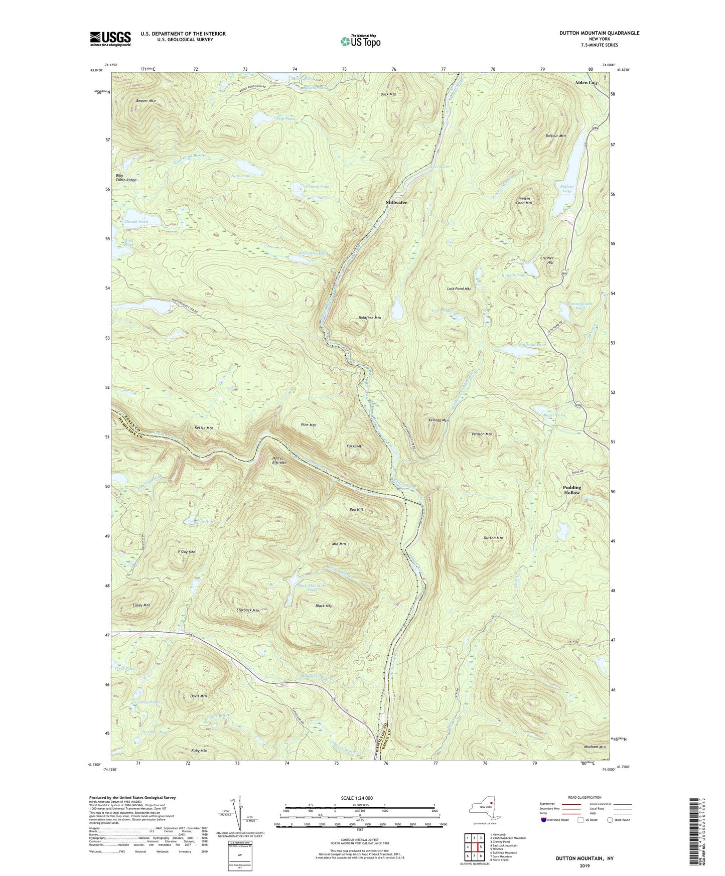
2023 topographic map quadrangle Dutton Mountain in the state of New York. Scale: 1:24000. Based on the newly updated USGS 7.5' US Topo map series, this map is in the following counties: Essex, Hamilton, Warren. The map contains contour data, water features, and other items you are used to seeing on USGS maps, but also has updated roads and other features. This is the next generation of topographic maps. Printed on high-quality waterproof paper with UV fade-resistant inks.
Quads adjacent to this one:
West: Bad Luck Mountain
Northwest: Newcomb
North: Vanderwhacker Mountain
Northeast: Cheney Pond
East: Minerva
Southeast: North Creek
South: Gore Mountain
Southwest: Bullhead Mountain
This map covers the same area as the classic USGS quad with code k43074g1.
Contains the following named places: Aiden Lair, Aldous Brook, Baldface Mountain, Balfour Lake, Balfour Lake Camp, Balfour Mountain, Beaver Mountain, Bell Mountain Brook, Bissell Pond, Black Mountain, Black Mountain Ponds, Boreas River, Buck Mountain, Bullhead Pond, Bullhead Pond Brook, Camp Baco, Camp Che-na-wah, Casey Mountain, Crusher Hill, Davis Mountain, Dutton Mountain, Fish Pond, Forks Mountain, Fox Hill, Gardner Pond, Grassy Pond, Grassy Ponds, Griffin Brook, Harris Rift Mountain, Hotwater Pond, Howe Marsh, Huntley Pond, Kellogg Mountain, Kettle Mountain, Little Rankin Pond, Lost Pond, Lost Pond Mountain, Middle Mountain, Moose Pond Club, Nate Pond, O K Slip Brook, P Gay Mountain, Pine Mountain, Powers Brook, Pudding Hollow, Pug Hole, Rankin Pond, Rankin Pond Mountain, Raquette Brook, Roper Pond, Starbuck Mountain, Stillwater, Thumb Pond, Town of Minerva, Twentyninth Pond, Venison Mountain, ZIP Code: 12851