MyTopo
Vanderwhacker Mountain New York US Topo Map
Couldn't load pickup availability
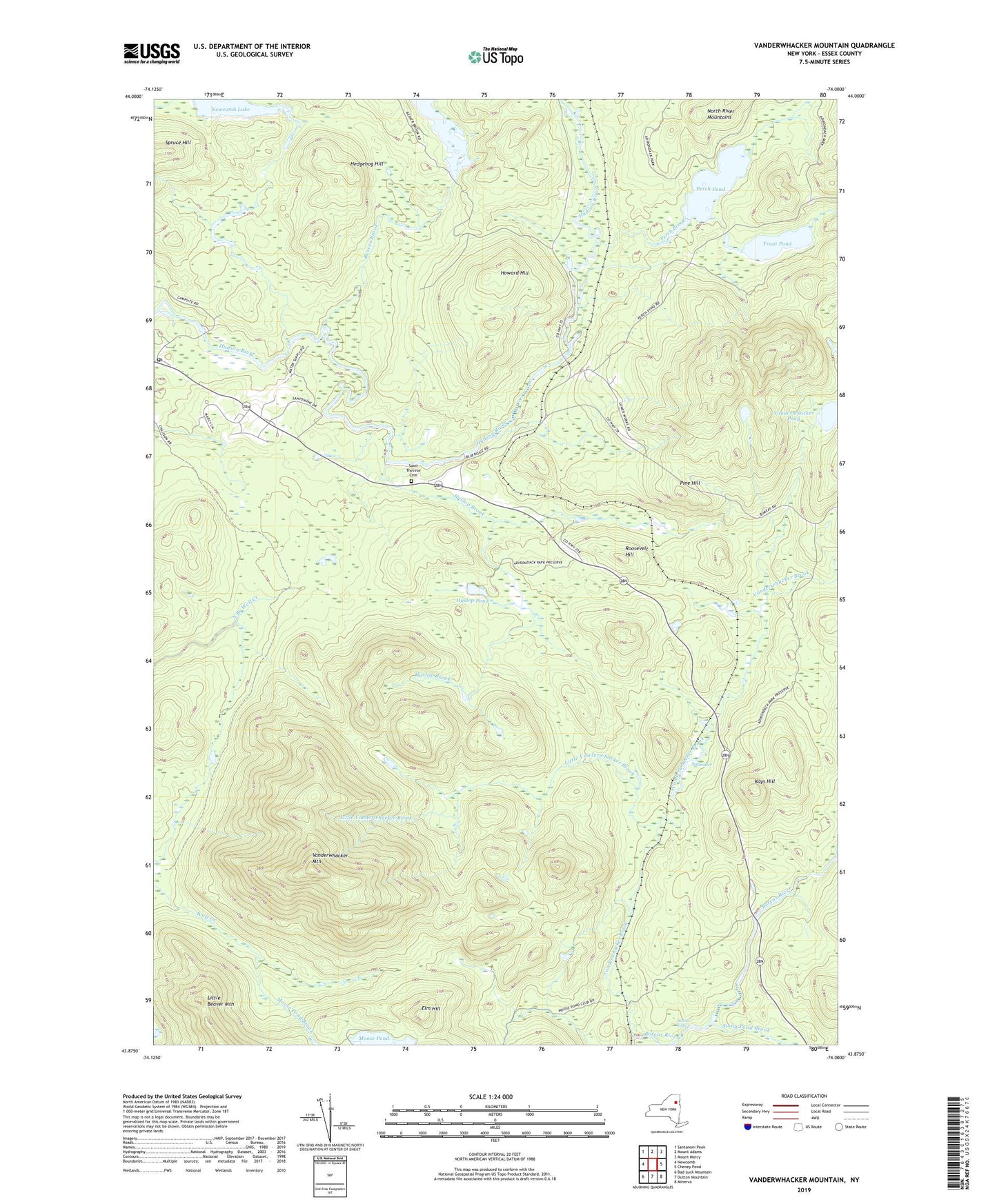
2023 topographic map quadrangle Vanderwhacker Mountain in the state of New York. Scale: 1:24000. Based on the newly updated USGS 7.5' US Topo map series, this map is in the following counties: Essex. The map contains contour data, water features, and other items you are used to seeing on USGS maps, but also has updated roads and other features. This is the next generation of topographic maps. Printed on high-quality waterproof paper with UV fade-resistant inks.
Quads adjacent to this one:
West: Newcomb
Northwest: Santanoni Peak
North: Mount Adams
Northeast: Mount Marcy
East: Cheney Pond
Southeast: Minerva
South: Dutton Mountain
Southwest: Bad Luck Mountain
Contains the following named places: Beaver Brook, Beaver Flow, Elm Hill, Hedgehog Hill, Hewitt Eddy, Howard Hill, Hyslop Brook, Hyslop Pond, Kays Hill, Little Beaver Mountain, Little Vanderwhacker Brook, Moose Pond, Moose Pond Brook, Newcomb Post Office, Newcomb River, Perch Brook, Perch Pond, Pine Hill, Roosevelt Hill, Saint Therese Cemetery, Saint Therese Church, Spruce Hill, Stillwater, Stony Pond Brook, Tahawus Club, Trout Pond, Vanderwhacker Brook, Vanderwhacker Mountain, Vanderwhacker Pond