MyTopo
Jericho New York US Topo Map
Couldn't load pickup availability
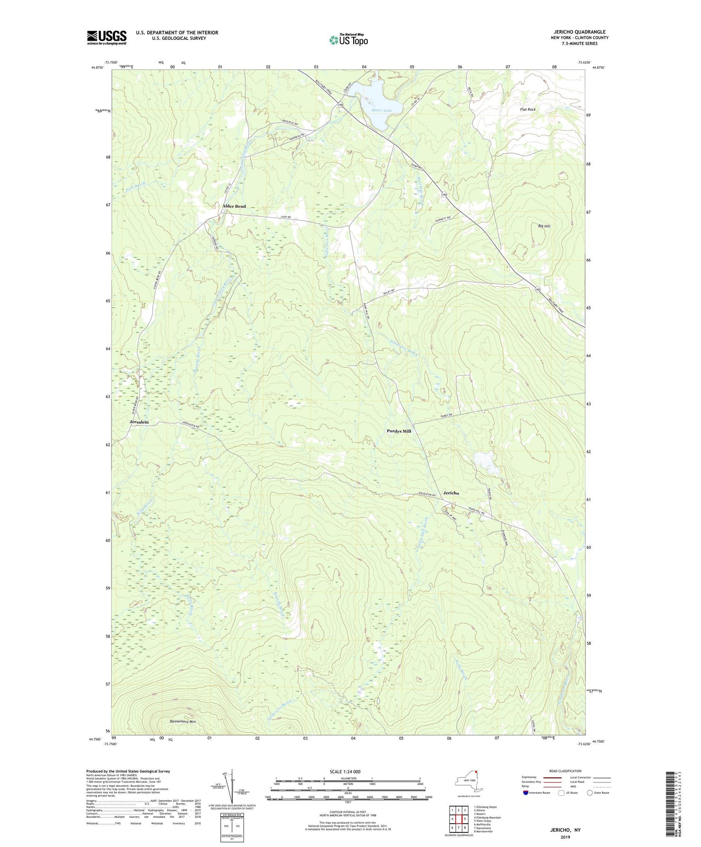
2023 topographic map quadrangle Jericho in the state of New York. Scale: 1:24000. Based on the newly updated USGS 7.5' US Topo map series, this map is in the following counties: Clinton. The map contains contour data, water features, and other items you are used to seeing on USGS maps, but also has updated roads and other features. This is the next generation of topographic maps. Printed on high-quality waterproof paper with UV fade-resistant inks.
Quads adjacent to this one:
West: Ellenburg Mountain
Northwest: Ellenburg Depot
North: Altona
Northeast: Mooers
East: West Chazy
Southeast: Morrisonville
South: Dannemora
Southwest: Moffitsville
This map covers the same area as the classic USGS quad with code o44073g6.
Contains the following named places: Alder Bend, Alder Bend School, Big Hill, Brandy Brook, Bullis Brook, Flat Rock, Half Mile Brook, Jericho, Jerusalem, King Brook, Miner Lake, Miner Lake State Park, Purdys Mill, Saint Alexis Church, School Number 8, Stillwater Brook, Town of Altona