
MyTopo
Morris New York US Topo Map
Couldn't load pickup availability
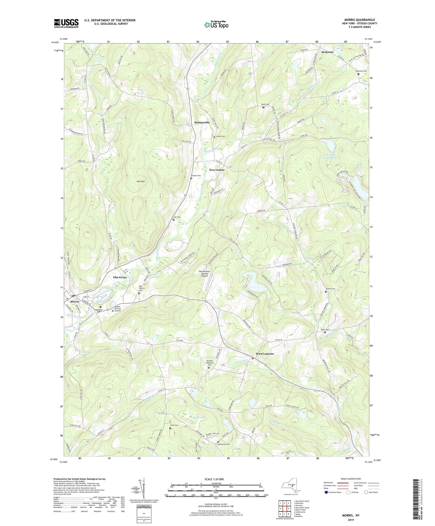
2019 topographic map quadrangle Morris in the state of New York. Scale: 1:24000. Based on the newly updated USGS 7.5' US Topo map series, this map is in the following counties: Otsego. The map contains contour data, water features, and other items you are used to seeing on USGS maps, but also has updated roads and other features. This is the next generation of topographic maps. Printed on high-quality waterproof paper with UV fade-resistant inks.
Quads adjacent to this one:
West: New Berlin South
Northwest: New Berlin North
North: Edmeston
Northeast: Hartwick
East: Mount Vision
Southeast: Oneonta
South: Otego
Southwest: Gilbertsville
Contains the following named places: Bennett Weatherly Cemetery, Blue Bird Hill Farm, Brown Cemetery, Buck Cemetery, Butts Cemetery, Butts Corners, Calhoun Creek, Chapin Cemetery, Colonial Ridge Golf Course, Cook Cemetery, Cooper Creek, Don Kichote-Quixote Airport, Edgewood Golf Course, Elm Grove, Gilbert Lake, Gilbert Lake State Park, Gill Hill, Hathaway Cemetery, Hillington Cemetery, Ketchum Corners, Lake Misery, Lake of the Twin Fawns, Lull Cemetery, Morris, Morris Fire Department, Morris Post Office, Naylor Corners, New Lisbon, Old Church Cemetery, Quaker Burying Ground, School Number 12, School Number 6, School Number 7, School Number 8, School Number 9, Smith Cemetery, Stetsonville, Stony Creek, Town of New Lisbon, Village of Morris, Welcome, Welcome Acres, Welcome Cemetery, West Laurens, West Laurens Fire Department, White Sky Farm, ZIP Codes: 13415, 13796, 13861


