MyTopo
North Wilmurt New York US Topo Map
Couldn't load pickup availability
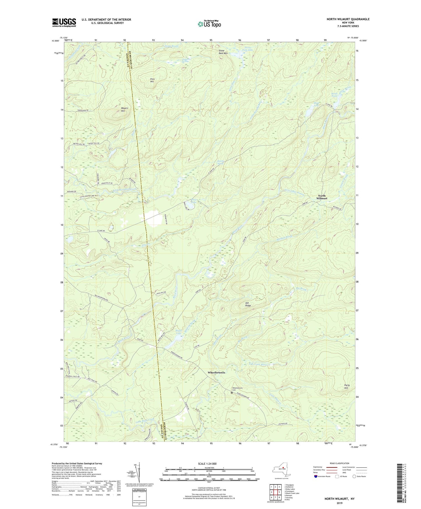
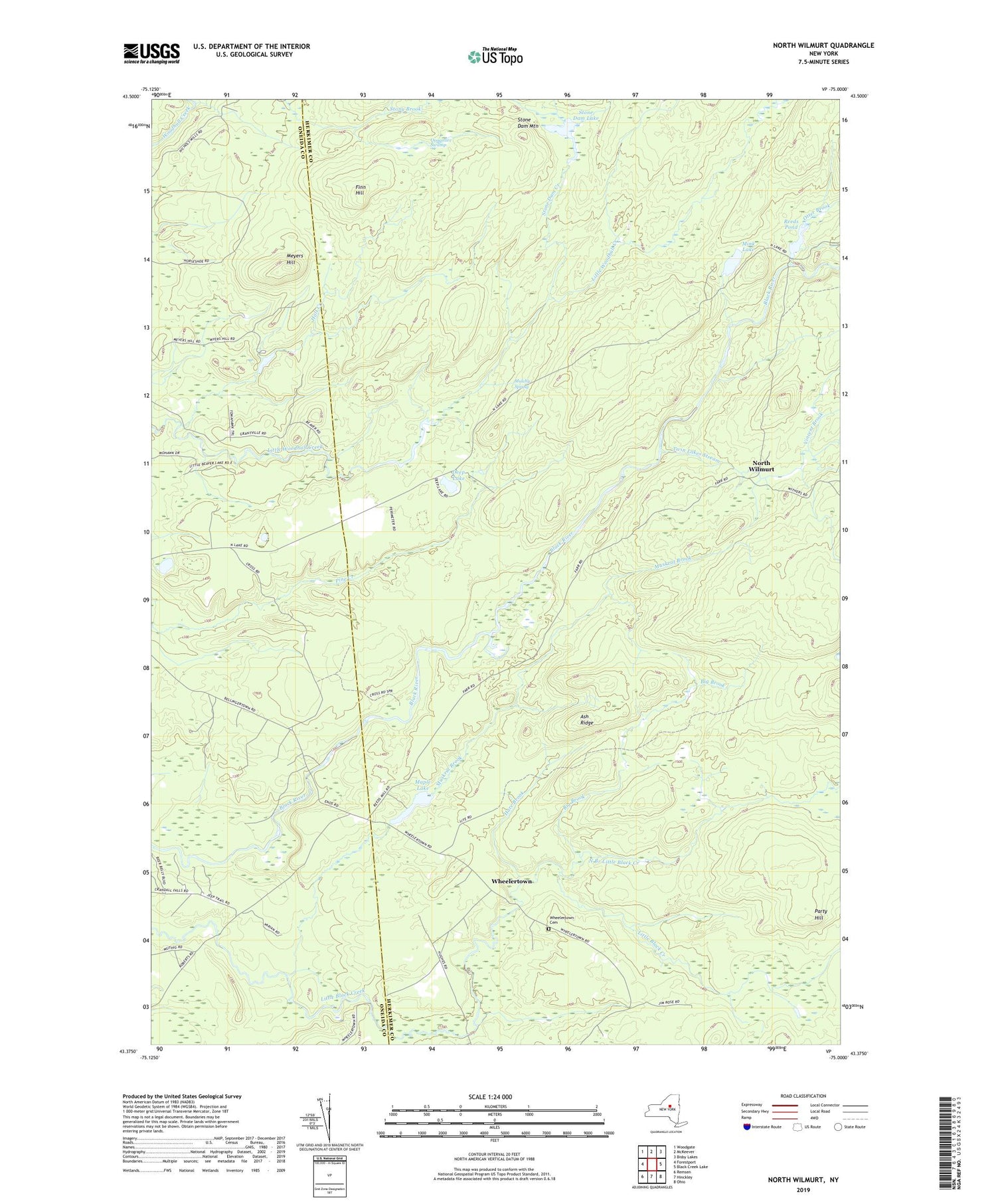
2019 topographic map quadrangle North Wilmurt in the state of New York. Scale: 1:24000. Based on the newly updated USGS 7.5' US Topo map series, this map is in the following counties: Herkimer, Oneida. The map contains contour data, water features, and other items you are used to seeing on USGS maps, but also has updated roads and other features. This is the next generation of topographic maps. Printed on high-quality waterproof paper with UV fade-resistant inks.
Quads adjacent to this one:
West: Forestport
Northwest: Woodgate
North: McKeever
Northeast: Bisby Lakes
East: Black Creek Lake
Southeast: Ohio
South: Hinckley
Southwest: Remsen
Contains the following named places: Ash Ridge, Big Brook, Deep Lake, Finn Hill, Forty Mountain Trail, Halt Creek, Hare Brook, Lyons Camp, Maple Lake, Meyers Hill, Mink Lake, Mulchy Spring, Muskrat Brook, North Branch Little Black Creek, North Wilmurt, Otter Brook, Party Hill, Quagmire Swamp, Reeds Pond, Stone Dam Creek, Stone Dam Lake, Stone Dam Lake Camp, Stone Dam Mountain, Stone Dam Trail, Twin Lakes Stream, Vincent Brook, Wheelertown, Wheelertown Cemetery