MyTopo
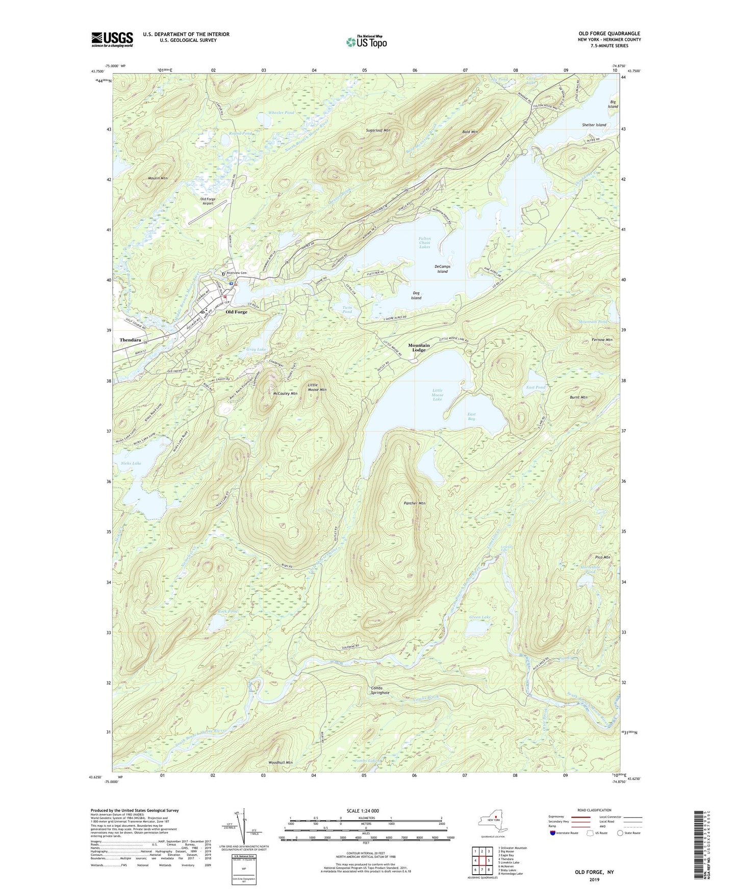
Old Forge New York US Topo Map
Couldn't load pickup availability
2019 topographic map quadrangle Old Forge in the state of New York. Scale: 1:24000. Based on the newly updated USGS 7.5' US Topo map series, this map is in the following counties: Herkimer. The map contains contour data, water features, and other items you are used to seeing on USGS maps, but also has updated roads and other features. This is the next generation of topographic maps. Printed on high-quality waterproof paper with UV fade-resistant inks.
Quads adjacent to this one:
West: Thendara
Northwest: Stillwater Mountain
North: Big Moose
Northeast: Eagle Bay
East: Limekiln Lake
Southeast: Honnedaga Lake
South: Bisby Lakes
Southwest: McKeever
Contains the following named places: Bald Mountain, Bald Mountain Pond, Beaver Brook, Big Island, Burnt Mountain, Combs Brook, Combs Springhole, DeCamps Island, Dog Island, Dwight Pond, East Bay, East Pond, Fernow Mountain, First Lake, Fly Pond, Gray Lake, Green Lake, Horseshoe Pond, Limekiln Creek, Limekiln Falls, Little Moose Lake, Little Moose Mountain, Little Moose Outlet, McCauley Mountain, Moulin Mountain, Mountain Lodge, Mountain Pond, Nameless Creek, Nicks Lake, North Branch Moose River, Old Forge, Old Forge Airport, Old Forge Camping Resort, Old Forge Census Designated Place, Old Forge Fire Department, Old Forge Library, Old Forge Post Office, Old Forge Volunteer Ambulance Corps, Otter Brook, Panther Lake, Panther Mountain, Pico Creek, Riverview Cemetery, Rock Pond, Round Pond, Second Lake, Shelter Island, Sugarloaf Mountain, Thendara Census Designated Place, Thendara Golf Club, Third Lake, Third Lake Creek, Town of Webb School, Twin Pond, Wheeler Pond, WUMA-FM (Old Forge), ZIP Code: 13420