MyTopo
Eagle Bay New York US Topo Map
Couldn't load pickup availability
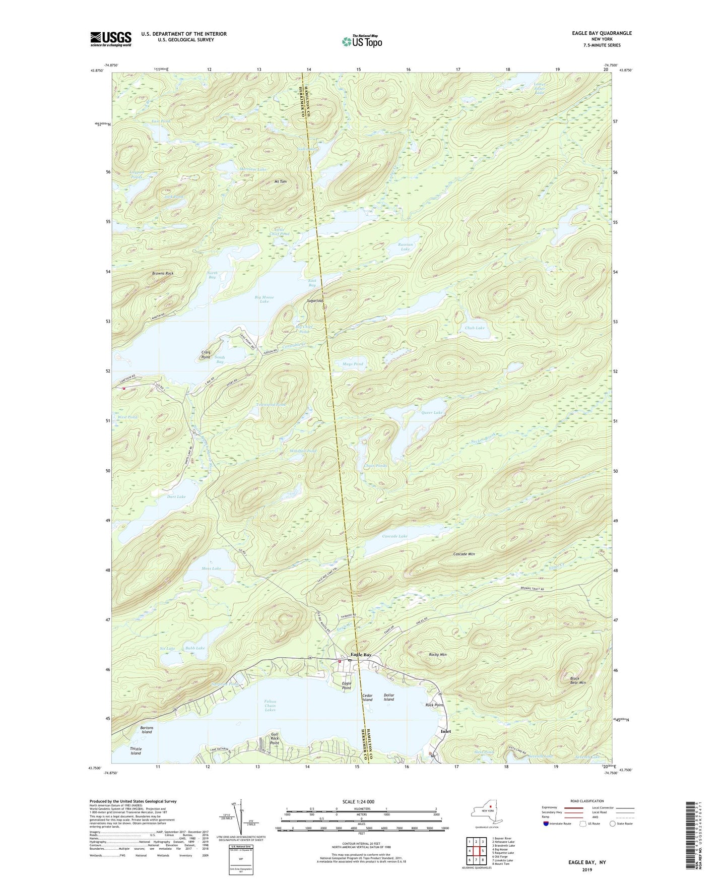
2023 topographic map quadrangle Eagle Bay in the state of New York. Scale: 1:24000. Based on the newly updated USGS 7.5' US Topo map series, this map is in the following counties: Hamilton, Herkimer. The map contains contour data, water features, and other items you are used to seeing on USGS maps, but also has updated roads and other features. This is the next generation of topographic maps. Printed on high-quality waterproof paper with UV fade-resistant inks.
Quads adjacent to this one:
West: Big Moose
Northwest: Beaver River
North: Nehasane Lake
Northeast: Brandreth Lake
East: Raquette Lake
Southeast: Mount Tom
South: Limekiln Lake
Southwest: Old Forge
This map covers the same area as the classic USGS quad with code k43074g7.
Contains the following named places: Andys Creek, Bartons Island, Big Chief Pond, Big Moose Fire Company Ambulance, Big Moose Lake, Black Bear Mountain, Browns Rock, Bubb Lake, Cascade Lake, Cascade Mountain, Cedar Island, Chain Ponds, Chub Lake, Constable Creek, Constable Pond, Craig Point, Dart Lake, Dollar Island, Eagle Bay, Eagle Bay Census Designated Place, Eagle Bay Post Office, Eagle Bay Volunteer Fire Company, Eagle Creek, Eagle Point, East Bay, East Pond, Fulton Chain Lakes, Gull Lakes, Gull Rock Point, Hess Pond, Inlet, Inlet Community Church, Inlet Post Office, Jock Pond, Lilypad Ponds, Little Chief Pond, Mays Pond, Merriam Lake, Moss Lake, Mount Tom, North Bay, Pigeon Lake, Queer Lake, Rock Point, Rocky Mountain, Russian Lake, Sis Lake, South Bay, Sugarloaf, Surprise Pond, Thistle Island, Townsend Pond, Windfall Pond