MyTopo
Big Moose New York US Topo Map
Couldn't load pickup availability
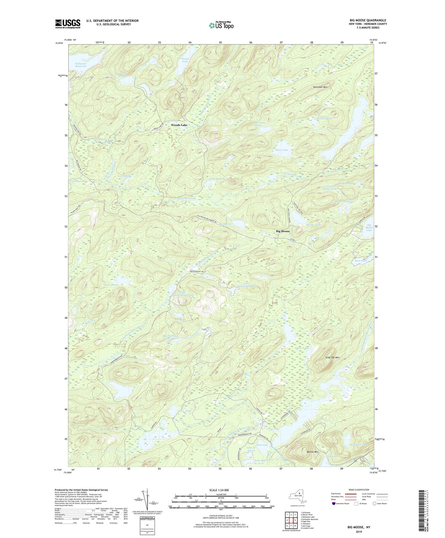
2023 topographic map quadrangle Big Moose in the state of New York. Scale: 1:24000. Based on the newly updated USGS 7.5' US Topo map series, this map is in the following counties: Herkimer. The map contains contour data, water features, and other items you are used to seeing on USGS maps, but also has updated roads and other features. This is the next generation of topographic maps. Printed on high-quality waterproof paper with UV fade-resistant inks.
Quads adjacent to this one:
West: Stillwater Mountain
Northwest: Stillwater
North: Beaver River
Northeast: Nehasane Lake
East: Eagle Bay
Southeast: Limekiln Lake
South: Old Forge
Southwest: Thendara
Contains the following named places: Bald Mountain Brook, Big Diamond Pond, Big Moose, Birch Creek, Bottle Mountain, Buck Pond, Camp Rondaxe, Carter Station, Cary Lake, Clear Pond, Cranberry Pond, Doe Pond, Fly Pond Outlet, Goose Pond, Independence Lake, Lake Kan-ac-to, Lake Rondaxe, Lake Te-jec-na, Little Birch Pond, Little Diamond Pond, Little Independence Pond, Little Rock Pond, Little Safford Lake, Lost Pond, Lyons Marsh, Melody Island, Mountain Pond, Oswego Pond, Pocket Ponds, Razorback Pond, Safford Pond, Shaw Creek, Silver Dollar Pond, Silver Lake, Slide Off Mountain, Snake Pond, South Pond, Squash Pond, Thirsty Pond, Town of Webb, Twitchell Creek, Twitchell Lake, Twitchell Mountain, West Lake, West Pond, Woods Lake, ZIP Code: 13331