MyTopo
Oswegatchie SE New York US Topo Map
Couldn't load pickup availability
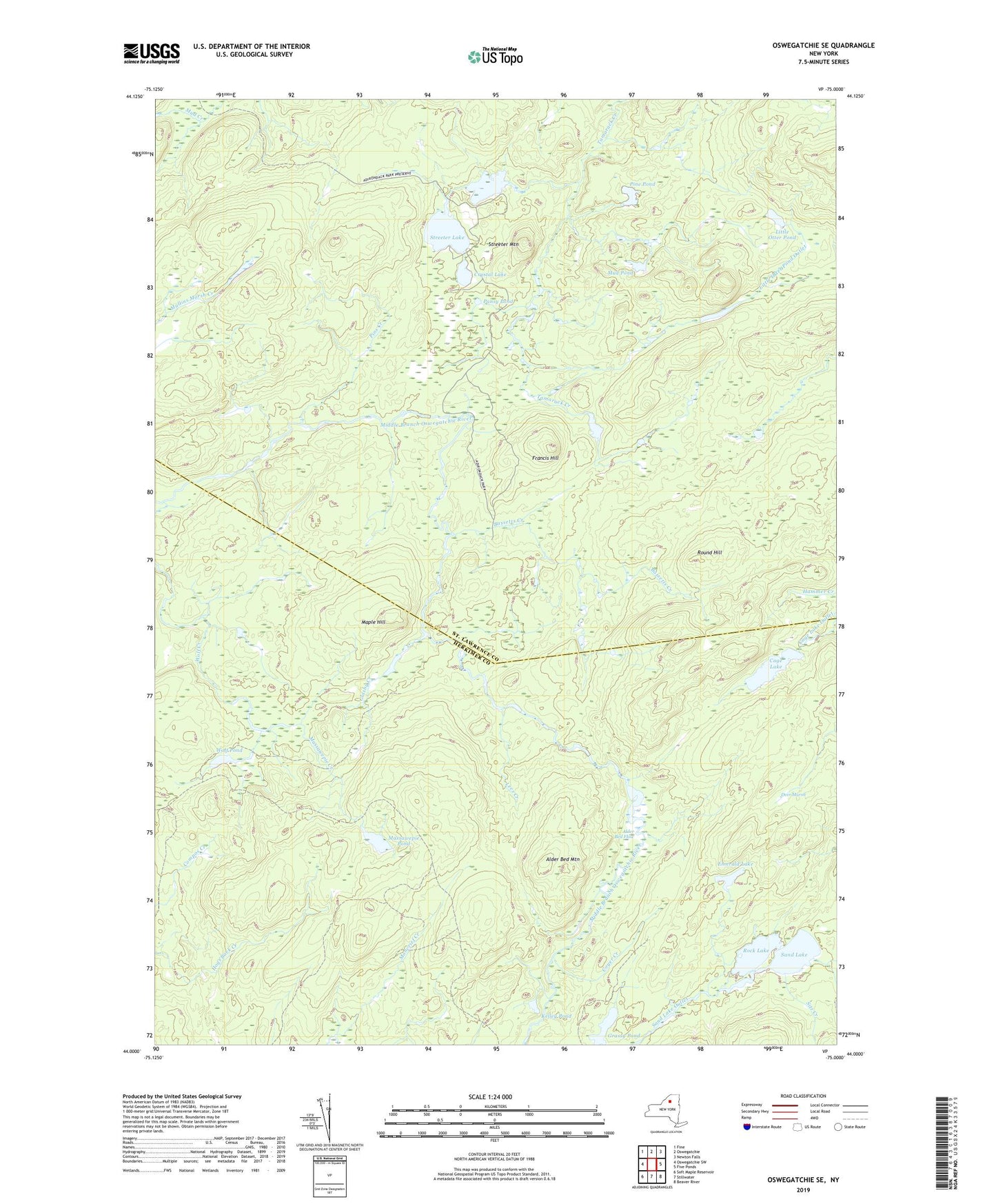
2019 topographic map quadrangle Oswegatchie SE in the state of New York. Scale: 1:24000. Based on the newly updated USGS 7.5' US Topo map series, this map is in the following counties: St. Lawrence, Herkimer. The map contains contour data, water features, and other items you are used to seeing on USGS maps, but also has updated roads and other features. This is the next generation of topographic maps. Printed on high-quality waterproof paper with UV fade-resistant inks.
Quads adjacent to this one:
West: Oswegatchie SW
Northwest: Fine
North: Oswegatchie
Northeast: Newton Falls
East: Five Ponds
Southeast: Beaver River
South: Stillwater
Southwest: Soft Maple Reservoir
Contains the following named places: Alder Bed Flow, Alder Bed Mountain, Bassetts Creek, Cage Lake, Coyer Creek, Crystal Lake, Deer Marsh, Emerald Lake, Francis Hill, Glasby Creek, Grassy Pond, Kelley Pond, Lees Creek, Little Otter Pond, Little Otter Pond Outlet, Maple Hill, Massawepie Creek, Massawepie Pond, Moncrief Creek, Mud Pond, Pansy Pond, Pine Pond, Pins Creek, Rock Lake, Round Hill, Sand Lake, Sitz Creek, Streeter Lake, Streeter Lake Outlet, Streeter Mountain, Wolf Creek, Wolf Pond, ZIP Code: 13690