
MyTopo
Panama New York US Topo Map
Couldn't load pickup availability
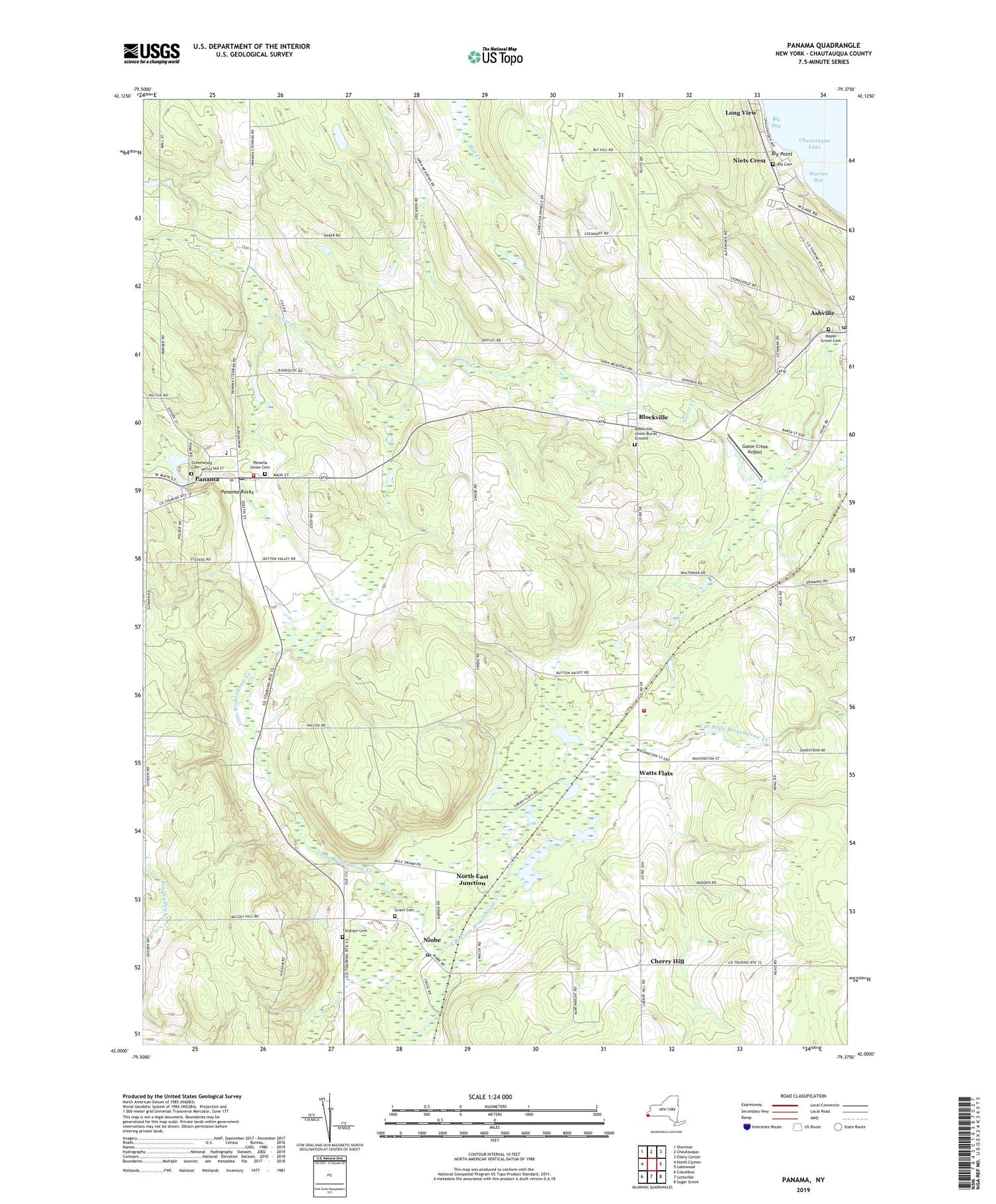
2019 topographic map quadrangle Panama in the state of New York. Scale: 1:24000. Based on the newly updated USGS 7.5' US Topo map series, this map is in the following counties: Chautauqua. The map contains contour data, water features, and other items you are used to seeing on USGS maps, but also has updated roads and other features. This is the next generation of topographic maps. Printed on high-quality waterproof paper with UV fade-resistant inks.
Quads adjacent to this one:
West: North Clymer
Northwest: Sherman
North: Chautauqua
Northeast: Ellery Center
East: Lakewood
Southeast: Sugar Grove
South: Lottsville
Southwest: Columbus
Contains the following named places: Ashville, Ashville Bay, Ashville Free Library, Ashville Methodist Church, Ashville Post Office, Baker School, Blockville, Blockville Union Burial Ground, Bly Cemetery, Bly Point, Cherry Hill, East Branch Little Brokenstraw Creek, Goose Creek Airport, Grant Cemetery, Greenwood Cemetery, Long View, Maple Grove Cemetery, Niets Crest, Niobe, Niobe Baptist Church, Niobe Post Office, North East Junction, Odell Farms, Our Lady of the Snows, Panama, Panama Baptist Church, Panama Fire Department Station 1, Panama Fire Department Station 2, Panama High School, Panama K - 6 School, Panama Post Office, Panama Rocks, Panama Union Cemetery, Panama United Methodist Church, Tillotson Cemetery, Town of Harmony, Village of Panama, Warner Bay, Watts Flats, Wesleyan Methodist Church, ZIP Code: 14710


