MyTopo
Sugar Grove Pennsylvania US Topo Map
Couldn't load pickup availability
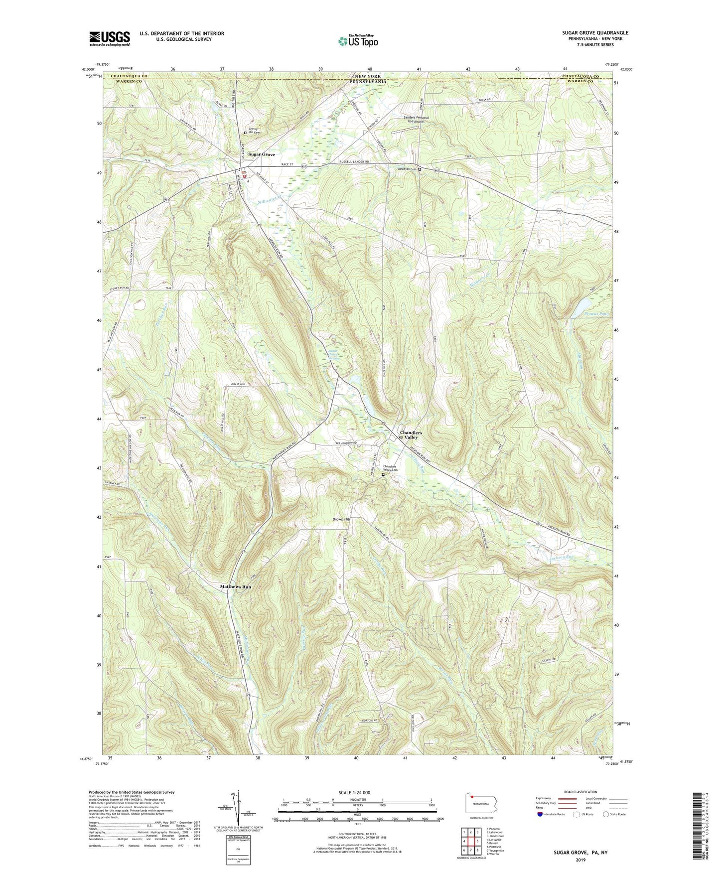
2023 topographic map quadrangle Sugar Grove in the state of Pennsylvania. Scale: 1:24000. Based on the newly updated USGS 7.5' US Topo map series, this map is in the following counties: Warren, Chautauqua. The map contains contour data, water features, and other items you are used to seeing on USGS maps, but also has updated roads and other features. This is the next generation of topographic maps. Printed on high-quality waterproof paper with UV fade-resistant inks.
Quads adjacent to this one:
West: Lottsville
Northwest: Panama
North: Lakewood
Northeast: Jamestown
East: Russell
Southeast: Warren
South: Youngsville
Southwest: Pittsfield
This map covers the same area as the classic USGS quad with code o41079h3.
Contains the following named places: Borough of Sugar Grove, Brown Hill, Brown Hill Church, Brown Hill School, Browns Pond, Chandlers Valley, Chandlers Valley Cemetery, Chandlers Valley Post Office, Cherry Hill Cemetery, Dalrymple Hill School, Frondelius Corners, Hamblin Hill School, Hazeltine School, Henning Hill School, Jackson Valley Golf Course, Kitchen School, Lansing Run, Matthews Run, Patchen Run, Peoples Church, Sanders Personal Use Airport, Sugar Grove, Sugar Grove Elementary School, Sugar Grove Oil Field, Sugar Grove Post Office, Sugar Grove Swamp, Sugar Grove Volunteer Fire Department / Sugar Grove Ambulance Service Station 63, Sugargrove Post Office, Telick Run, Township of Sugar Grove, Wesleyan Cemetery, White School, ZIP Codes: 16312, 16350