MyTopo
Peasleeville New York US Topo Map
Couldn't load pickup availability
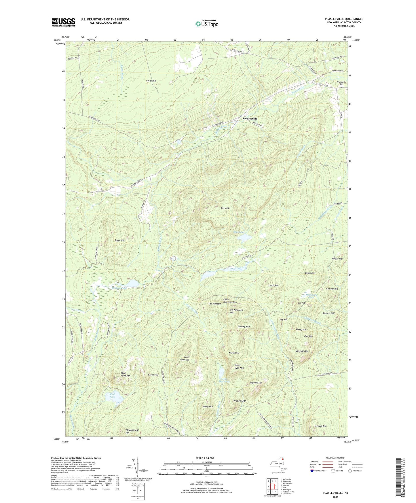
2023 topographic map quadrangle Peasleeville in the state of New York. Scale: 1:24000. Based on the newly updated USGS 7.5' US Topo map series, this map is in the following counties: Clinton. The map contains contour data, water features, and other items you are used to seeing on USGS maps, but also has updated roads and other features. This is the next generation of topographic maps. Printed on high-quality waterproof paper with UV fade-resistant inks.
Quads adjacent to this one:
West: Redford
Northwest: Moffitsville
North: Dannemora
Northeast: Morrisonville
East: Peru
Southeast: Clintonville
South: Au Sable Forks
Southwest: Wilmington
This map covers the same area as the classic USGS quad with code o44073e6.
Contains the following named places: Bennett Hill, Big Hill, Big Nineteen Mountain, Blake Brook, Buckley Mountain, Burnt Hill, Conway Hill, Crossway Mountain, Flat Mountain, Green Mountain, Hogback Mountain, Larry Ryan Mountain, Little Mud Pond, Little Nineteen Mountain, Lynch Mountain, McGinnity Pond, Military Pond, Mitchell Mountain, Mud Pond, Nancy Ryan Mountain, North Pole, Oak Hill, Paddy Mountain, Peasleeville, Peasleeville Cemetery, Quinn Mountain, Sheep Mountain, Slush Pond, Slush Pond Mountain, Stewart Mountain, Sugar Hill, Terry Mountain, The Pinnacle, Walker Hill, Whippoorwill Mountain, WPTZ-TV (North Pole), Zion Church, ZIP Code: 12985