MyTopo
Point Rock New York US Topo Map
Couldn't load pickup availability
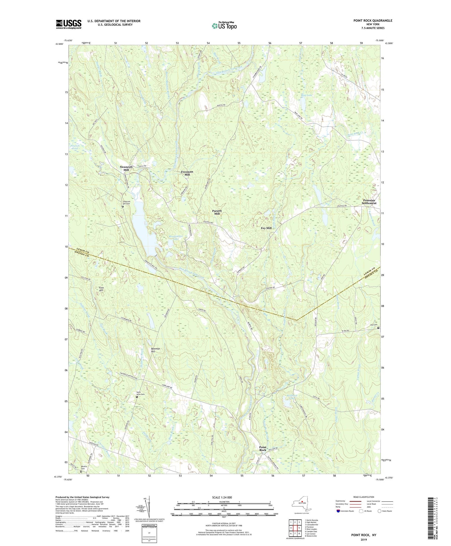
2019 topographic map quadrangle Point Rock in the state of New York. Scale: 1:24000. Based on the newly updated USGS 7.5' US Topo map series, this map is in the following counties: Lewis, Oneida. The map contains contour data, water features, and other items you are used to seeing on USGS maps, but also has updated roads and other features. This is the next generation of topographic maps. Printed on high-quality waterproof paper with UV fade-resistant inks.
Quads adjacent to this one:
West: Florence
Northwest: North Osceola
North: High Market
Northeast: Constableville
East: West Leyden
Southeast: Westernville
South: Lee Center
Southwest: Camden East
Contains the following named places: Ava Cemetery, Beaver Meadow Brook, Bloodsucker Lake, Bowman Hill, Broad Brook, Bullhead Lake, Camp Kingsley, Cody Brook, Fey Mill, Finn Brook, Finn Hill, Freeman Mill, Harger Creek, Hennesey Brook, Heron Brook, Mack Brook, Mud Brook, Mud Lake, Parson Mill, Pigeon Brook, Point Rock, Point Rock Creek, Pond Brook, Powlish Pond Brook, Prussian Settlement, Saint Anns Cemetery, Saint Anns Church, School Number 10, School Number 14, School Number 2, School Number 3, School Number 6, School Number 8, Searles Brook, Smith Lake, Sullivan Brook, Sunset Corners, Swancott Mill, Swancott Mill Cemetery, Town of Lewis, Whiffin Cemetery, ZIP Code: 13489