MyTopo
Prattsville New York US Topo Map
Couldn't load pickup availability
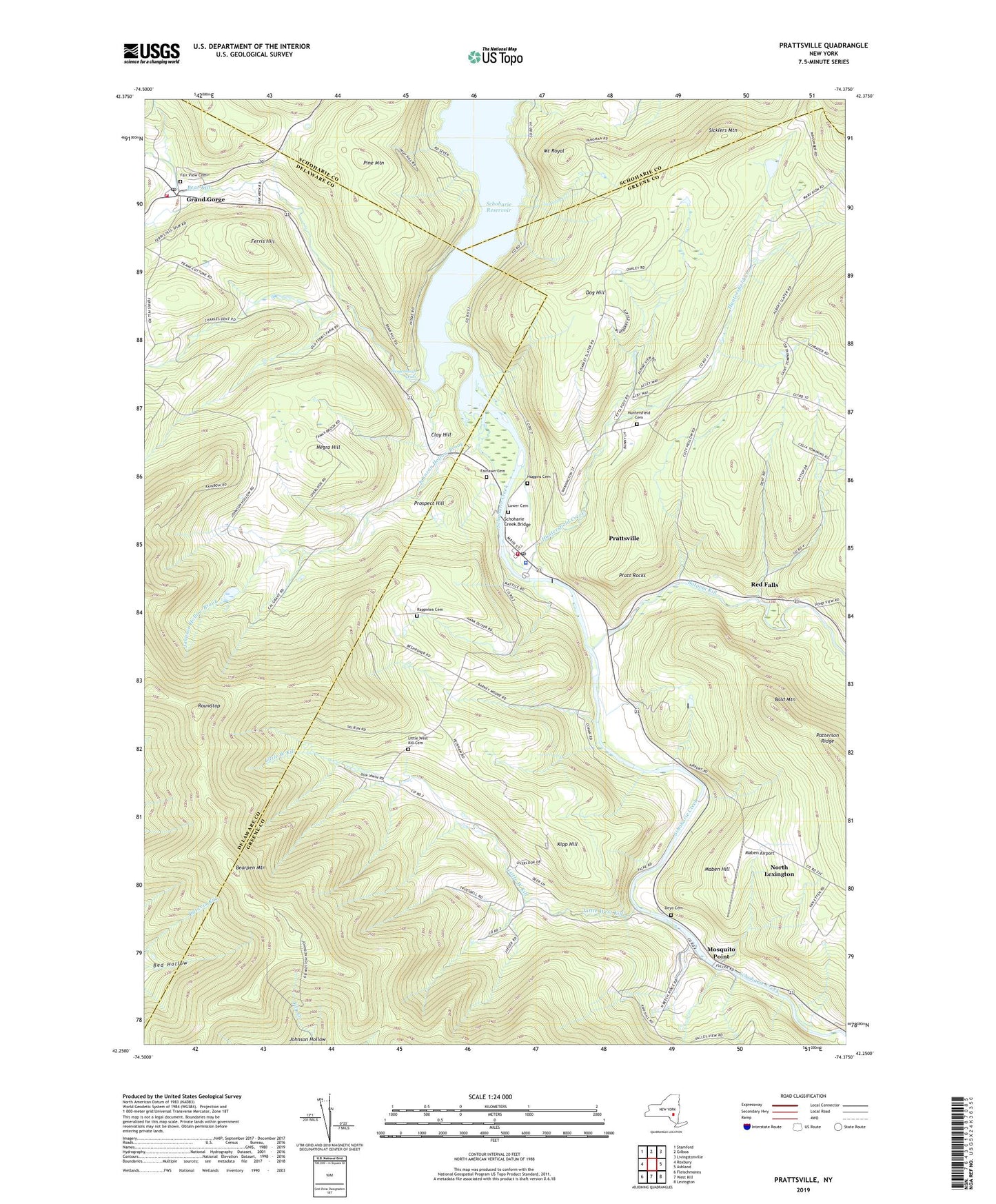
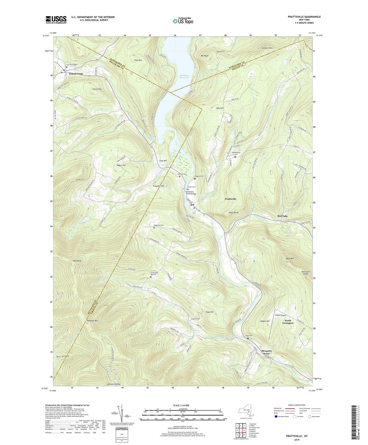
2019 topographic map quadrangle Prattsville in the state of New York. Scale: 1:24000. Based on the newly updated USGS 7.5' US Topo map series, this map is in the following counties: Greene, Delaware, Schoharie. The map contains contour data, water features, and other items you are used to seeing on USGS maps, but also has updated roads and other features. This is the next generation of topographic maps. Printed on high-quality waterproof paper with UV fade-resistant inks.
Quads adjacent to this one:
West: Roxbury
Northwest: Stamford
North: Gilboa
Northeast: Livingstonville
East: Ashland
Southeast: Lexington
South: West Kill
Southwest: Fleischmanns
Contains the following named places: Bald Mountain, Batavia Kill, Bear Kill, Bearpen Mountain, Clay Hill, Deyo Cemetery, Dog Hill, Fair View Cemetery, Fairlawn Cemetery, Falke's Quarry, Fall Brook, Ferris Hill, Four Corners, Grand Gorge, Grand Gorge Hose Company 1, Grand Gorge Post Office, Grand Gorge United Methodist Church, Hardenburgh Falls, Huggins Cemetery, Huntersfield Cemetery, Huntersfield Creek, Johnson Hollow Brook, Kipp Hill, Little West Kill, Little West Kill Cemetery, Little West Kill School, Lower Cemetery, Maben Airport, Maben Hill, Moores Mobile Home Park, Mosquito Point, Mount Royal, Negro Hill, North Lexington, Patterson Ridge, Pine Mountain, Pratt Rocks, Prattsville, Prattsville Census Designated Place, Prattsville Hose Company, Prattsville Post Office, Prattsville United Methodist Church, Prospect Hill, Rappelea Cemetery, Red Falls, Roundtop, Schoharie Creek Bridge, Schoharie Reservoir, School Number 1, Sicklers Mountain, Toad Hollow, Town of Prattsville, Zadock Pratt Museum, ZIP Code: 12468