MyTopo
Rawson New York US Topo Map
Couldn't load pickup availability
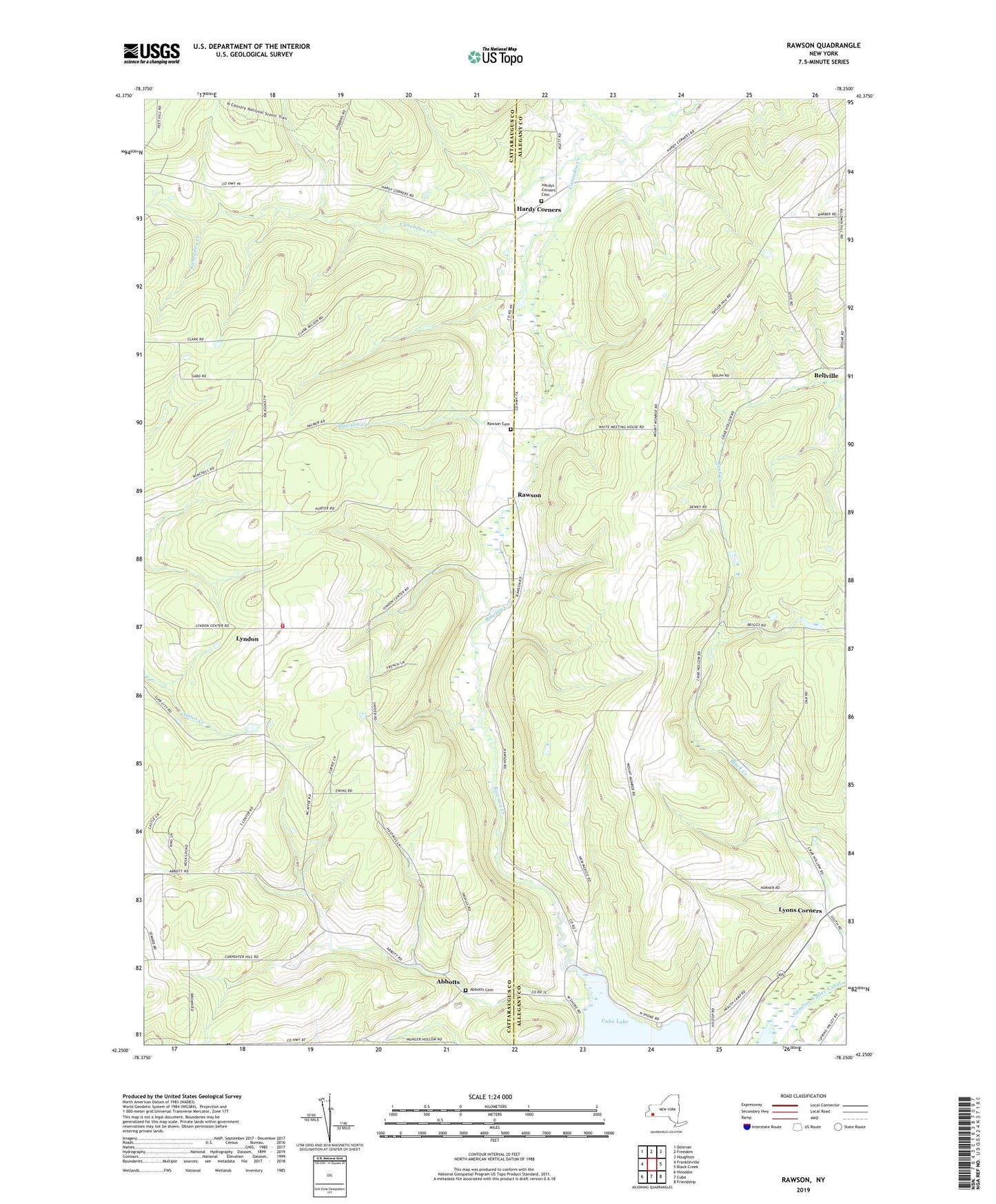
2019 topographic map quadrangle Rawson in the state of New York. Scale: 1:24000. Based on the newly updated USGS 7.5' US Topo map series, this map is in the following counties: Cattaraugus, Allegany. The map contains contour data, water features, and other items you are used to seeing on USGS maps, but also has updated roads and other features. This is the next generation of topographic maps. Printed on high-quality waterproof paper with UV fade-resistant inks.
Quads adjacent to this one:
West: Franklinville
Northwest: Delevan
North: Freedom
Northeast: Houghton
East: Black Creek
Southeast: Friendship
South: Cuba
Southwest: Hinsdale
Contains the following named places: Abbotts, Abbotts Cemetery, Bellville, Bellville Church, Hardy Corners, Hardys Corners Cemetery, Lyndon, Lyndon Volunteer Fire Company, Lyons Corners, Rawson, Rawson Cemetery, Rawson Church, Rawson Creek, Rawson Valley, Strzelec Farm, Town of Lyndon, Town of New Hudson, Wild Geese Farm