
MyTopo
Rondout Reservoir New York US Topo Map
Couldn't load pickup availability
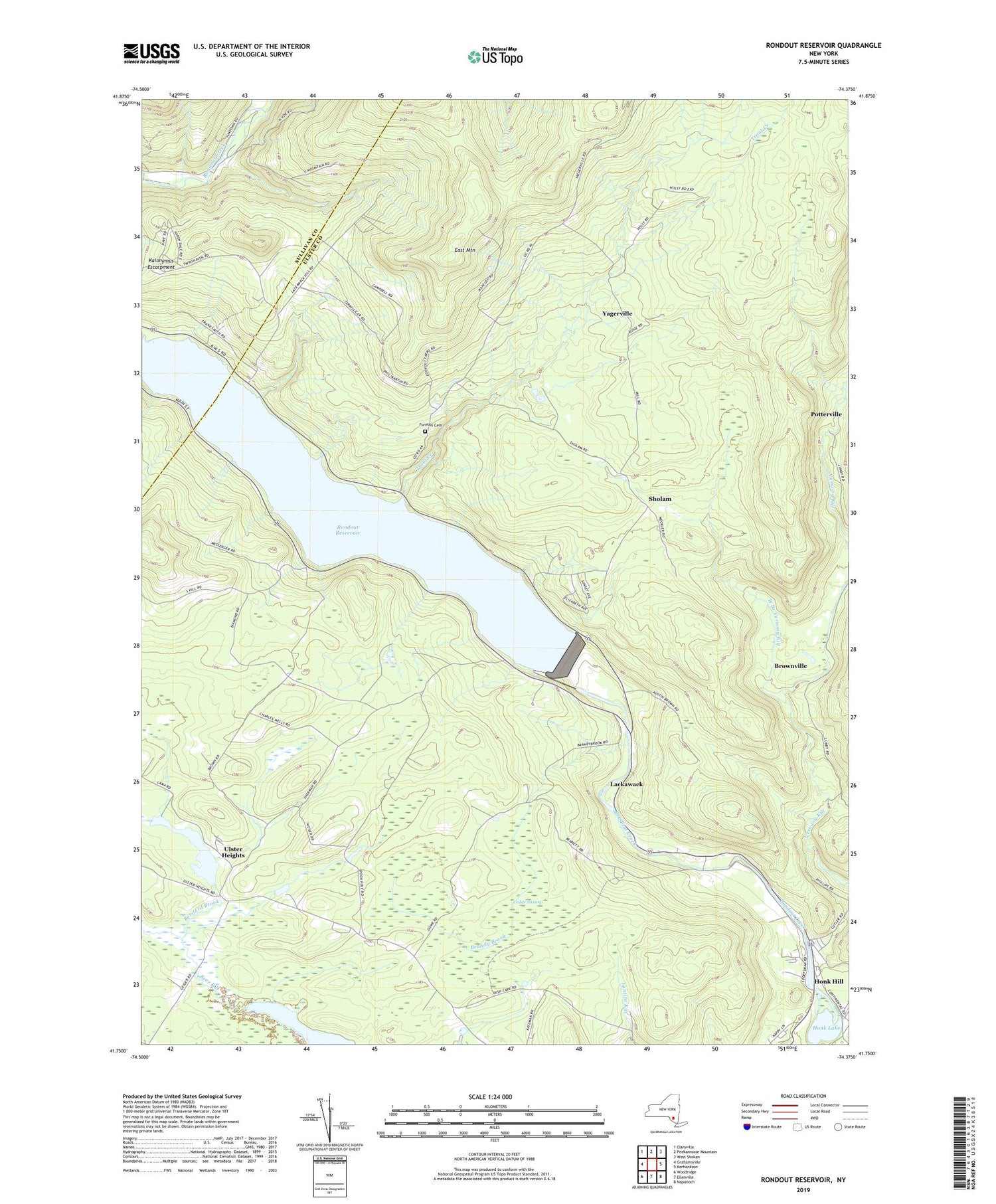
2019 topographic map quadrangle Rondout Reservoir in the state of New York. Scale: 1:24000. Based on the newly updated USGS 7.5' US Topo map series, this map is in the following counties: Ulster, Sullivan. The map contains contour data, water features, and other items you are used to seeing on USGS maps, but also has updated roads and other features. This is the next generation of topographic maps. Printed on high-quality waterproof paper with UV fade-resistant inks.
Quads adjacent to this one:
West: Grahamsville
Northwest: Claryville
North: Peekamoose Mountain
Northeast: West Shokan
East: Kerhonkson
Southeast: Napanoch
South: Ellenville
Southwest: Woodridge
Contains the following named places: August Farm, Botsford Brook, Brandy Brook, Brownville, Cedar Swamp, District School 17, East Mountain, Eureka Baptist Church, Furman Cemetery, Hillsdale School, Honk Hill, Honk Lake, Jenny Brook Mobile Home Park, Kalonymus Escarpment, Lackawack, Lackawack School, Merriman Dam, Potterville, Rondout Reservoir, Rusty Plough Farm, Shady Acre Mobile Home Park, Sholam, South Hill School, Stangle Hill School, Sunrise Manor, Town of Wawarsing, Trout Creek, Tunessassa Lodge, Ulster Heights, Ulster Heights Lake, Ulster Heights Lower School, West Branch Vernooy Kill, Yagerville, Yagerville School, Yama Hills Farm, ZIP Code: 12458


