MyTopo
Harpersfield New York US Topo Map
Couldn't load pickup availability
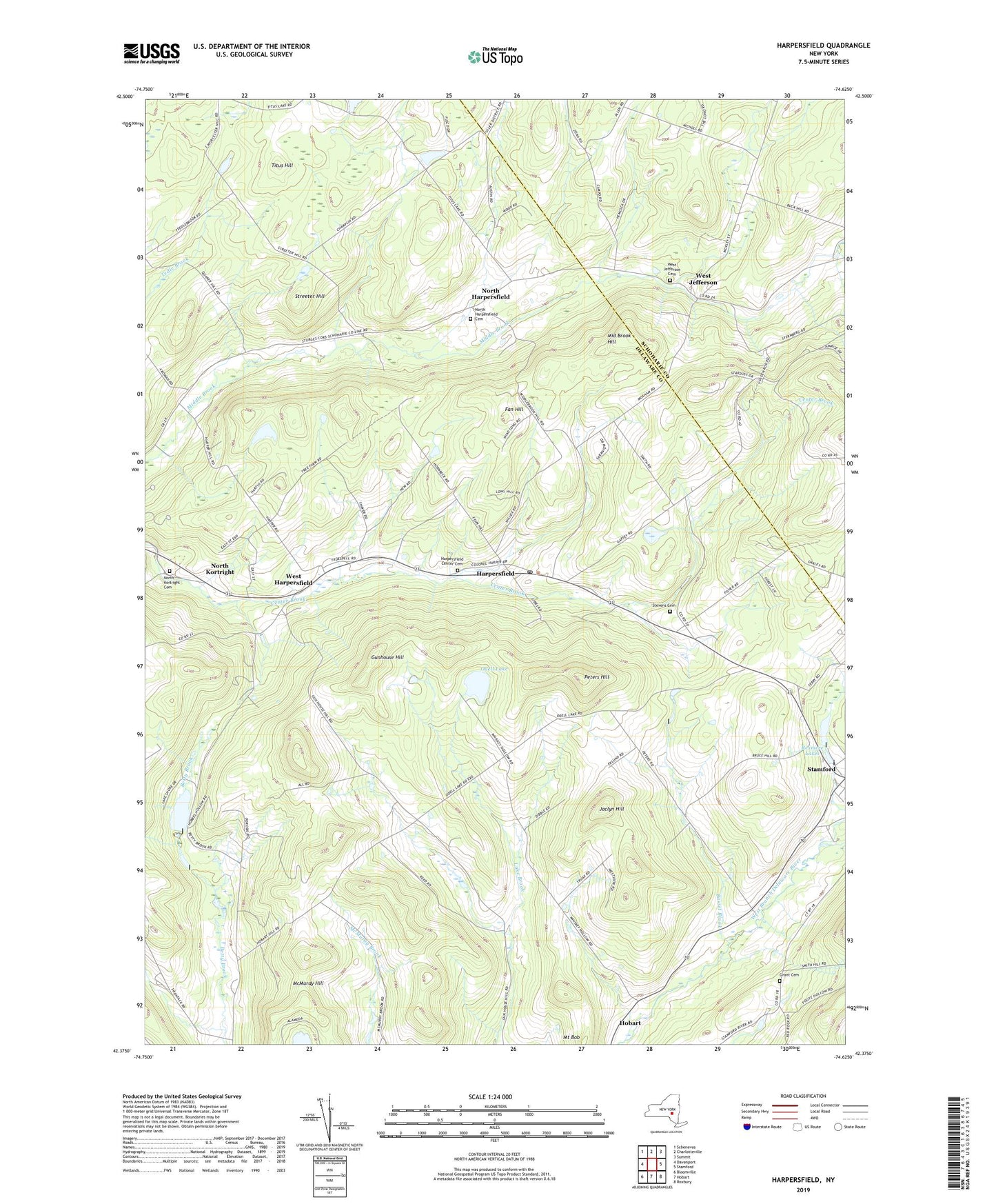
2023 topographic map quadrangle Harpersfield in the state of New York. Scale: 1:24000. Based on the newly updated USGS 7.5' US Topo map series, this map is in the following counties: Delaware, Schoharie. The map contains contour data, water features, and other items you are used to seeing on USGS maps, but also has updated roads and other features. This is the next generation of topographic maps. Printed on high-quality waterproof paper with UV fade-resistant inks.
Quads adjacent to this one:
West: Davenport
Northwest: Schenevus
North: Charlotteville
Northeast: Summit
East: Stamford
Southeast: Roxbury
South: Hobart
Southwest: Bloomville
This map covers the same area as the classic USGS quad with code o42074d6.
Contains the following named places: Basset Brook, Fan Hill, Grant Cemetery, Gunhouse Hill, Harpersfield, Harpersfield Center Cemetery, Harpersfield Post Office, Jaclyn Hill, Middle Brook Hill, Mount Bob, North Harpersfield, North Harpersfield Cemetery, North Kortright, North Kortright Cemetery, Odell Lake, Peters Hill, Rexmere Lakes, Robinson Terrace, School Number 5, School Number 6, Seventh Heaven Assisted Living Center, Shaver Hill Farm, Stamford Golf Club, Stamford Sewage Treatment Plant, Stevens Cemetery, Streeter Hill, Titus Hill, Town of Harpersfield, West Harpersfield, West Jefferson, West Jefferson Cemetery, Whisky Hollow, ZIP Codes: 12093, 13786, 13842