
MyTopo
Schuyler Lake New York US Topo Map
Couldn't load pickup availability
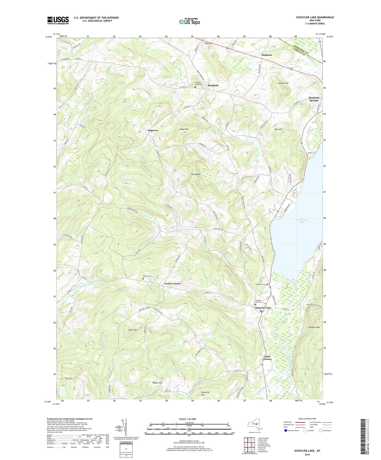
2019 topographic map quadrangle Schuyler Lake in the state of New York. Scale: 1:24000. Based on the newly updated USGS 7.5' US Topo map series, this map is in the following counties: Otsego, Herkimer. The map contains contour data, water features, and other items you are used to seeing on USGS maps, but also has updated roads and other features. This is the next generation of topographic maps. Printed on high-quality waterproof paper with UV fade-resistant inks.
Quads adjacent to this one:
West: Unadilla Forks
Northwest: West Winfield
North: Millers Mills
Northeast: Jordanville
East: Richfield Springs
Southeast: Cooperstown
South: Hartwick
Southwest: Edmeston
Contains the following named places: Angel Hill, Brainard Corners, Brighton, Canadarago Lake, Cobblestone School, Dogtown, Exeter Cemetery, Exeter Corner, Gunset Hill, Hawk Hill, Herkimer Cemetery, Herkimer Creek, Hyder Creek, Kingdom Hall of Jehovahs Witnesses, Lidell Corners, Lidell Creek, Mink Creek, Nine Hill, Phinney Creek, Pleasant Valley School, Pray Hill, Punchbowl, Richfield, Ryder School, School Number 5, School Number 6, Schuyler Lake, Schuyler Lake Cemetery, Schuyler Lake Census Designated Place, Schuyler Lake Post Office, Schuyler Lake Volunteer Fire Department, Town of Exeter, Town of Richfield, Twilight Rest Cemetery


