MyTopo
Smithville Flats New York US Topo Map
Couldn't load pickup availability
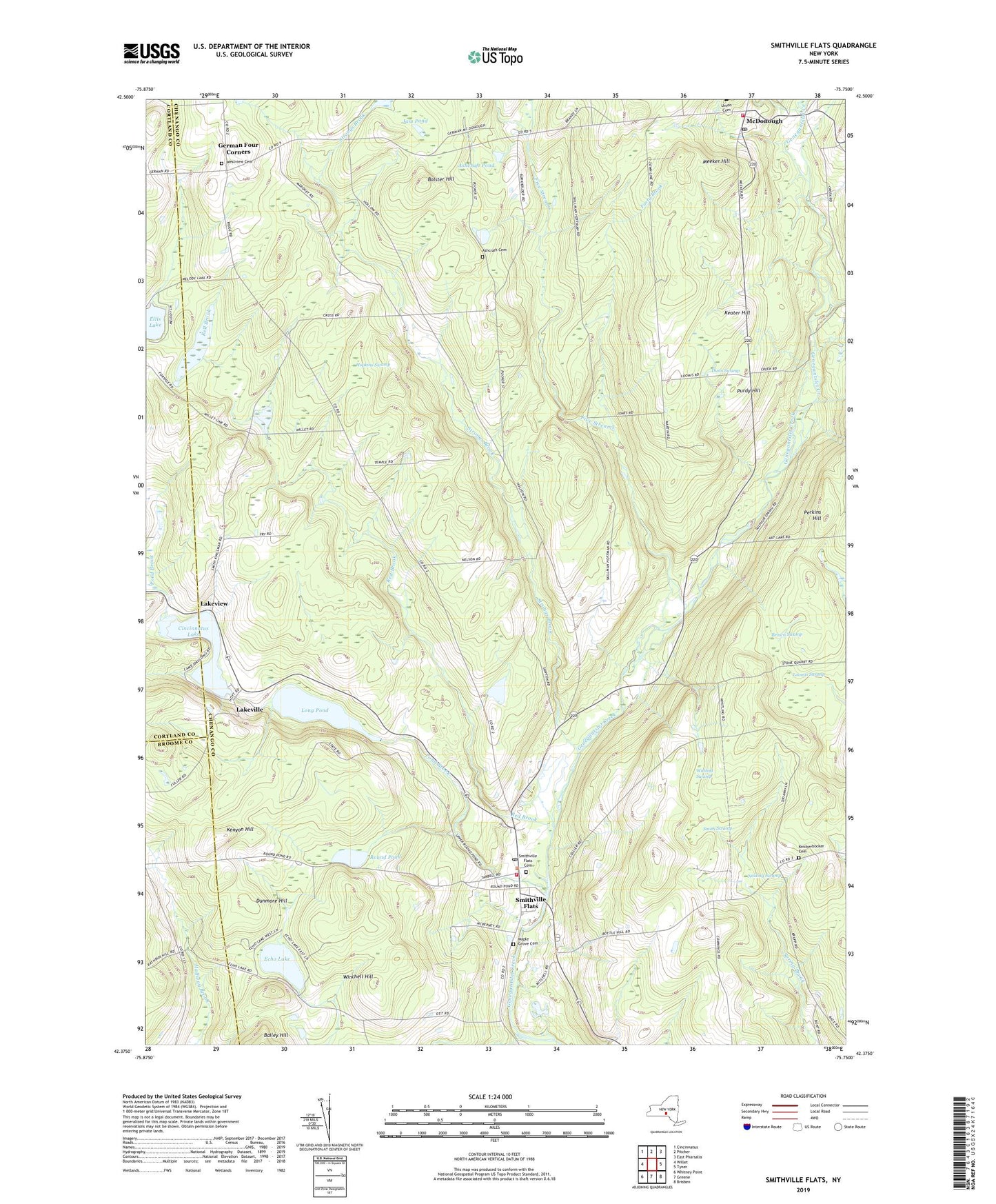
2019 topographic map quadrangle Smithville Flats in the state of New York. Scale: 1:24000. Based on the newly updated USGS 7.5' US Topo map series, this map is in the following counties: Chenango, Cortland, Broome. The map contains contour data, water features, and other items you are used to seeing on USGS maps, but also has updated roads and other features. This is the next generation of topographic maps. Printed on high-quality waterproof paper with UV fade-resistant inks.
Quads adjacent to this one:
West: Willet
Northwest: Cincinnatus
North: Pitcher
Northeast: East Pharsalia
East: Tyner
Southeast: Brisben
South: Greene
Southwest: Whitney Point
Contains the following named places: Ashcraft Cemetery, Ashcraft Pond, Barnes Corners, Bolster Hill, Brown Swamp, Cincinnatus Lake, Dunmore Hill, Dunn Swamp, Echo Lake, Ellis Lake, Five Streams, Forty Brook, Genegantslet Volunteer Fire Company, German Four Corners, Hopkins Swamp, Jam Pond, Keater Hill, Kenyon Hill, Knickerbocker Cemetery, Lakeview, Lakeville, Long Pond, Loomis Swamp, Maple Grove Cemetery, Mariams School, McDonough, McDonough Fire Department, McDonough Post Office, Meeker Hill, Neiding Swamp, Peppermint Brook, Perkins Hill, Pond Brook, Purdy Hill, Red Brook, Round Pond, School Number 1, School Number 3, Smith Swamp, Smithville Flats, Smithville Flats Cemetery, Smithville Flats Census Designated Place, Smithville Flats Post Office, Strongs Brook, Town of German, Town of Smithville, Westview Cemetery, Wilcox Corners, Winchell Hill, Wittling Swamp, ZIP Code: 13841