MyTopo
East Pharsalia New York US Topo Map
Couldn't load pickup availability
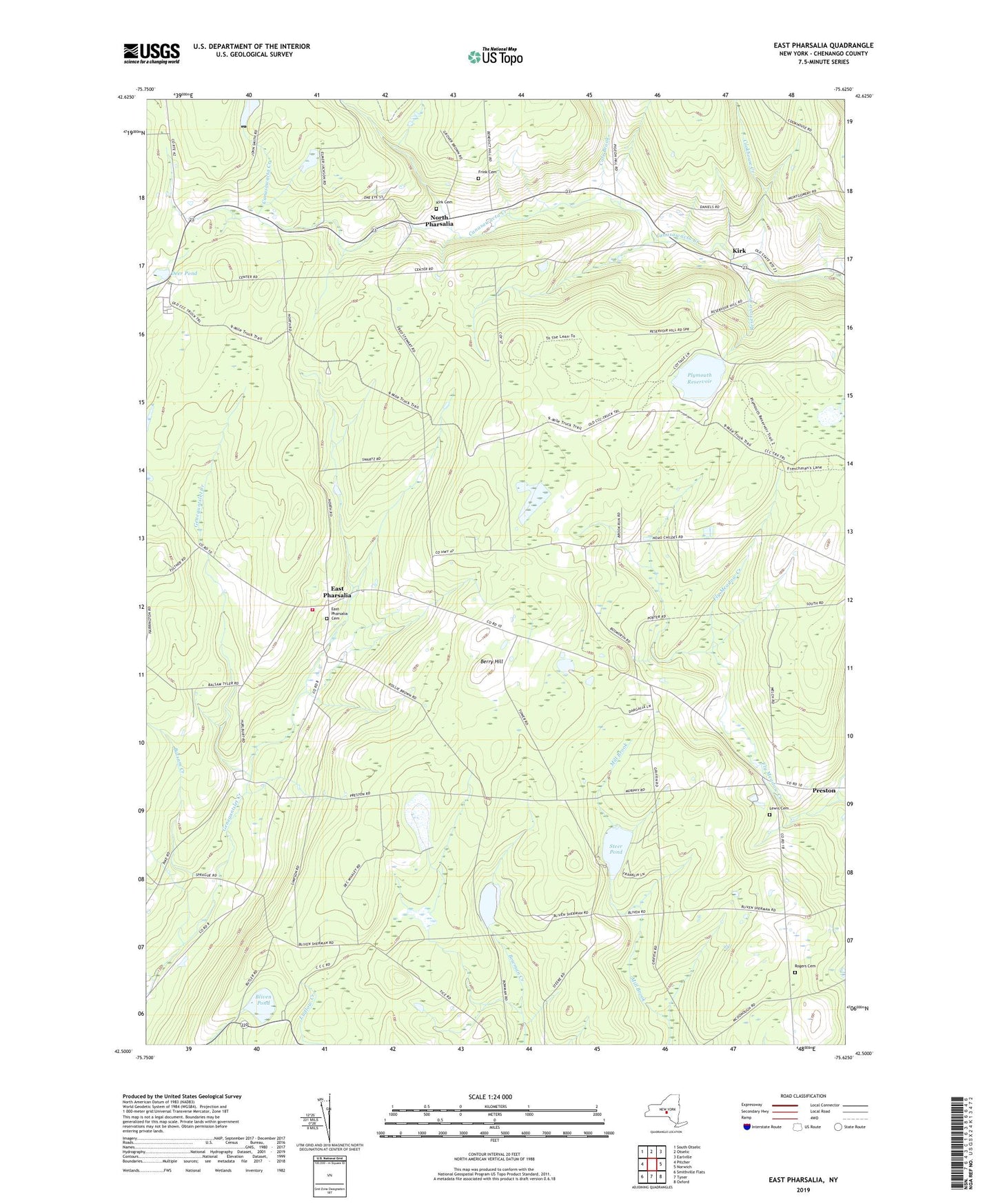
2023 topographic map quadrangle East Pharsalia in the state of New York. Scale: 1:24000. Based on the newly updated USGS 7.5' US Topo map series, this map is in the following counties: Chenango. The map contains contour data, water features, and other items you are used to seeing on USGS maps, but also has updated roads and other features. This is the next generation of topographic maps. Printed on high-quality waterproof paper with UV fade-resistant inks.
Quads adjacent to this one:
West: Pitcher
Northwest: South Otselic
North: Otselic
Northeast: Earlville
East: Norwich
Southeast: Oxford
South: Tyner
Southwest: Smithville Flats
This map covers the same area as the classic USGS quad with code o42075e6.
Contains the following named places: Balsam Creek, Berry Hill, Bliven Pond, Chenango County Landfill, Cole Brook, Cookhouse Creek, Deer Pond, East Pharsalia, East Pharsalia Cemetery, Frink Cemetery, High Meadow Farm, Kirk, Kirk Cemetery, Lewis Cemetery, North Pharsalia, Pharsalia Fire Company, Plymouth Reservoir, Reservoir Creek, Rogers Cemetery, Round Pond, School Number 1, School Number 10, School Number 12, School Number 4, School Number 5, School Number 7, Steer Pond, Town of McDonough, Town of Pharsalia, ZIP Code: 13844