MyTopo
South Canisteo New York US Topo Map
Couldn't load pickup availability
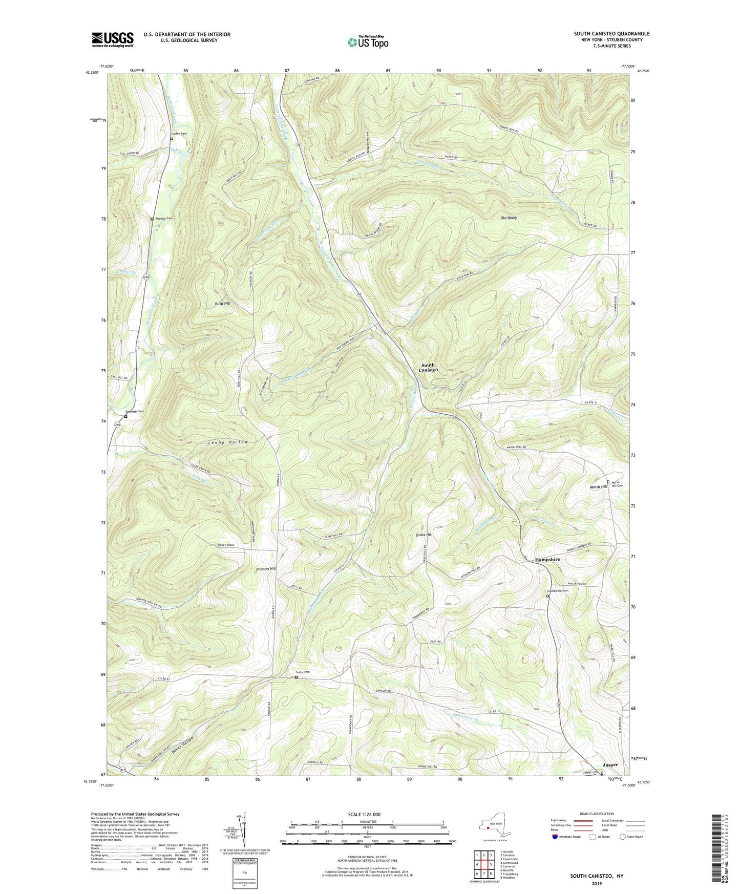
2019 topographic map quadrangle South Canisteo in the state of New York. Scale: 1:24000. Based on the newly updated USGS 7.5' US Topo map series, this map is in the following counties: Steuben. The map contains contour data, water features, and other items you are used to seeing on USGS maps, but also has updated roads and other features. This is the next generation of topographic maps. Printed on high-quality waterproof paper with UV fade-resistant inks.
Quads adjacent to this one:
West: Greenwood
Northwest: Hornell
North: Canisteo
Northeast: Towlesville
East: Cameron
Southeast: Woodhull
South: Troupsburg
Southwest: Rexville
Contains the following named places: Banks Hollow, Barkalow Hollow, Bennetts, Bennetts Cemetery, Bennetts Creek Bible Church, Brickyard Creek, Bush Hill, Bush Hill School, Carter Cemetery, Carter School, Dennis Corners, Dennis Creek, Drake School, Fall Creek, Grass Hill, Gravel Run, Gravel Run Hill School, Gravel Run School, Gully Cemetery, Gully School, Hampshire, Hampshire Cemetery, Jackson Hill, Jasper Cemetery, Klein School, Leahy Hollow, Marsh Hill, Marsh Hill Cemetery, Milwaukee Creek, Norton Hollow School, Old Blady, Peak Creek, Putman School, Red Spring Run, Rock Run, Slate Creek, South Canisteo, Spaulding Hollow, Spring Brook Church, State Road School, Sugar Creek, Thomas Cemetery, Town of Canisteo, Town of Jasper, Two Bridge Run, West Jasper Wesleyan Church, Woodward School, ZIP Code: 14823