MyTopo
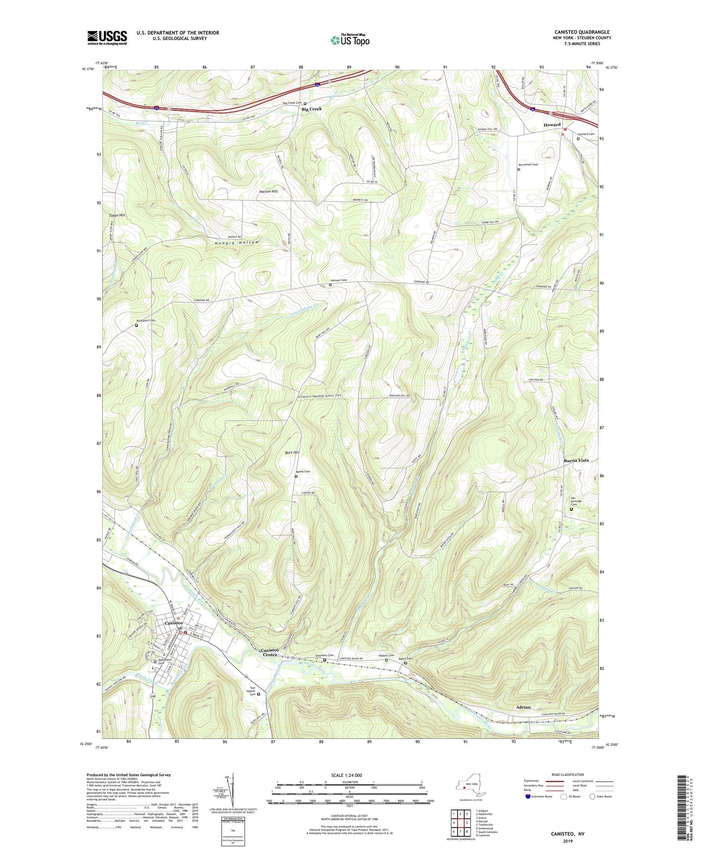
Canisteo New York US Topo Map
Couldn't load pickup availability
2023 topographic map quadrangle Canisteo in the state of New York. Scale: 1:24000. Based on the newly updated USGS 7.5' US Topo map series, this map is in the following counties: Steuben. The map contains contour data, water features, and other items you are used to seeing on USGS maps, but also has updated roads and other features. This is the next generation of topographic maps. Printed on high-quality waterproof paper with UV fade-resistant inks.
Quads adjacent to this one:
West: Hornell
Northwest: Arkport
North: Haskinville
Northeast: Avoca
East: Towlesville
Southeast: Cameron
South: South Canisteo
Southwest: Greenwood
This map covers the same area as the classic USGS quad with code o42077c5.
Contains the following named places: Adrian, Baker Cemetery, Baker Creek, Bennetts Creek, Big Creek, Big Creek Cemetery, Bird Hill School, Buena Vista, Buena Vista Wesleyan Church, Burt Hill, Butcher Corner, Canisteo, Canisteo - Greenwood Elementary School, Canisteo - Greenwood High School, Canisteo Center, Canisteo Fire Department, Canisteo Post Office, Canisteo Valley Assembly of God, Canisteo Wesleyan Church, Colonel Bills Creek, Coopers Plains United Methodist Church, Cunningham Creek, First Baptist Church, First Presbyterian Church, Hallett Cemetery, Hamilton School, Hammer Creek, Horton Hill, Howard, Howard Cemetery, Howard Public Library, Howard Volunteer Fire Department, Hungry Hollow, Johnson Cemetery, Kingdom Hall of Jehovahs Witnesses, McConnell Cemetery, Meeks Cemetery, Misick School, Nicholson Cemetery, Obes Glen, Palmer Farms, Purdy Creek, Ridge School, Saint Joachim's Church, Stephens Cemetery, Stephens Creek, Taylor Hollow, Tom Hallett Cemetery, Towle School, Town of Howard, Turnpike School, Tuttle Creek, Van Delinder Cemetery, Van Horn School, Village of Canisteo, Wimodaughsian Free Library, Woodlawn Cemetery