MyTopo
South Valley New York US Topo Map
Couldn't load pickup availability
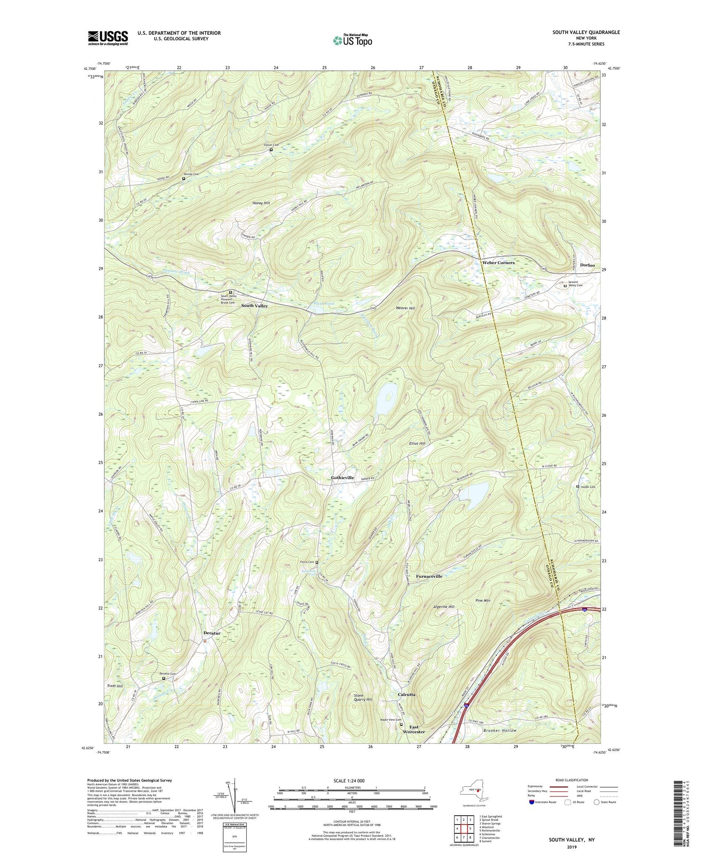
2019 topographic map quadrangle South Valley in the state of New York. Scale: 1:24000. Based on the newly updated USGS 7.5' US Topo map series, this map is in the following counties: Otsego, Schoharie. The map contains contour data, water features, and other items you are used to seeing on USGS maps, but also has updated roads and other features. This is the next generation of topographic maps. Printed on high-quality waterproof paper with UV fade-resistant inks.
Quads adjacent to this one:
West: Westford
Northwest: East Springfield
North: Sprout Brook
Northeast: Sharon Springs
East: Richmondville
Southeast: Summit
South: Charlotteville
Southwest: Schenevus
Contains the following named places: Algerine Hill, Bear Swamp Pond, Brooker Hollow, Butler Corners, Buttermilk Falls, Calcutta, Decatur, Decatur Cemetery, East Worcester Census Designated Place, Elliot Hill, Ferris Cemetery, Furnaceville, Gothicville, Honey Hill, Houck Cemetery, Maple View Cemetery, Pine Mountain, Plank Pond, School Number 1, School Number 19, School Number 2, School Number 4, School Number 6, School Number 9, Seward Valley Cemetery, Sissum Cemetery, South Valley, South Valley Pleasant Brook Cemetery, Stone Quarry Hill, Town of Decatur, Town of Roseboom, Treet Hill, Weaver Hill, Weber Corners, Winnie Cemetery