MyTopo
Charlotteville New York US Topo Map
Couldn't load pickup availability
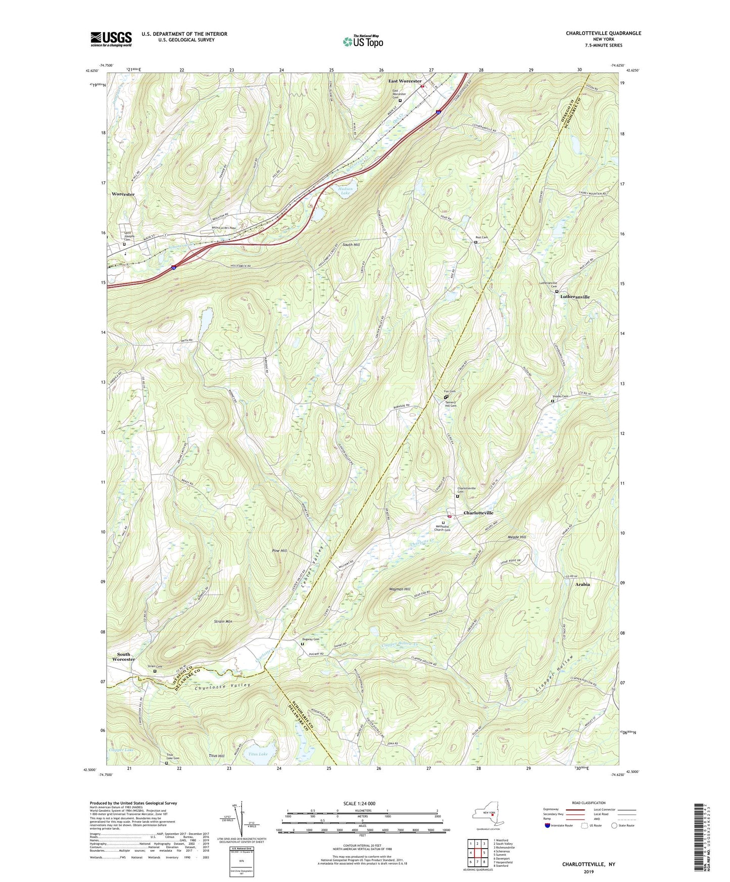
2023 topographic map quadrangle Charlotteville in the state of New York. Scale: 1:24000. Based on the newly updated USGS 7.5' US Topo map series, this map is in the following counties: Otsego, Schoharie, Delaware. The map contains contour data, water features, and other items you are used to seeing on USGS maps, but also has updated roads and other features. This is the next generation of topographic maps. Printed on high-quality waterproof paper with UV fade-resistant inks.
Quads adjacent to this one:
West: Schenevus
Northwest: Westford
North: South Valley
Northeast: Richmondville
East: Summit
Southeast: Stamford
South: Harpersfield
Southwest: Davenport
This map covers the same area as the classic USGS quad with code o42074e6.
Contains the following named places: Arabia, Baird Corners, Barton Corners, Center Valley, Center Valley School, Central School, Charlotteville, Charlotteville Cemetery, Charlotteville Post Office, Charlotteville Volunteer Fire Department, Clapper Hollow, Clapper Hollow Creek, Clapper Hollow School, Dugway Cemetery, East Worcester, East Worcester Cemetery, East Worcester Hose Company 1, East Worcester Post Office, Fox Cemetery, Fuller District School Number Four, Hall School, Hollenbeck School, Hudson Lake, Lutheranville, Lutheranville Cemetery, Meade Hill, Methodist Church Cemetery, Mud Lake School, Oak Creek, Oliver School, Pine Hill, Post Cemetery, Saint Josephs Catholic Church, Saint Josephs Cemetery, School Number 15, School Number 9, Snooks Cemetery, South Worcester, Strain Cemetery, Strain Mountain, Tannery Hill Cemetery, Titus Lake, Titus Lake Cemetery, Town of Worcester, Wayman Hill, Worcester Census Designated Place, Worcester Free Library, Worcester School, Worcester Westbound Rest Area, ZIP Codes: 12036, 12064, 12197