MyTopo
Summit New York US Topo Map
Couldn't load pickup availability
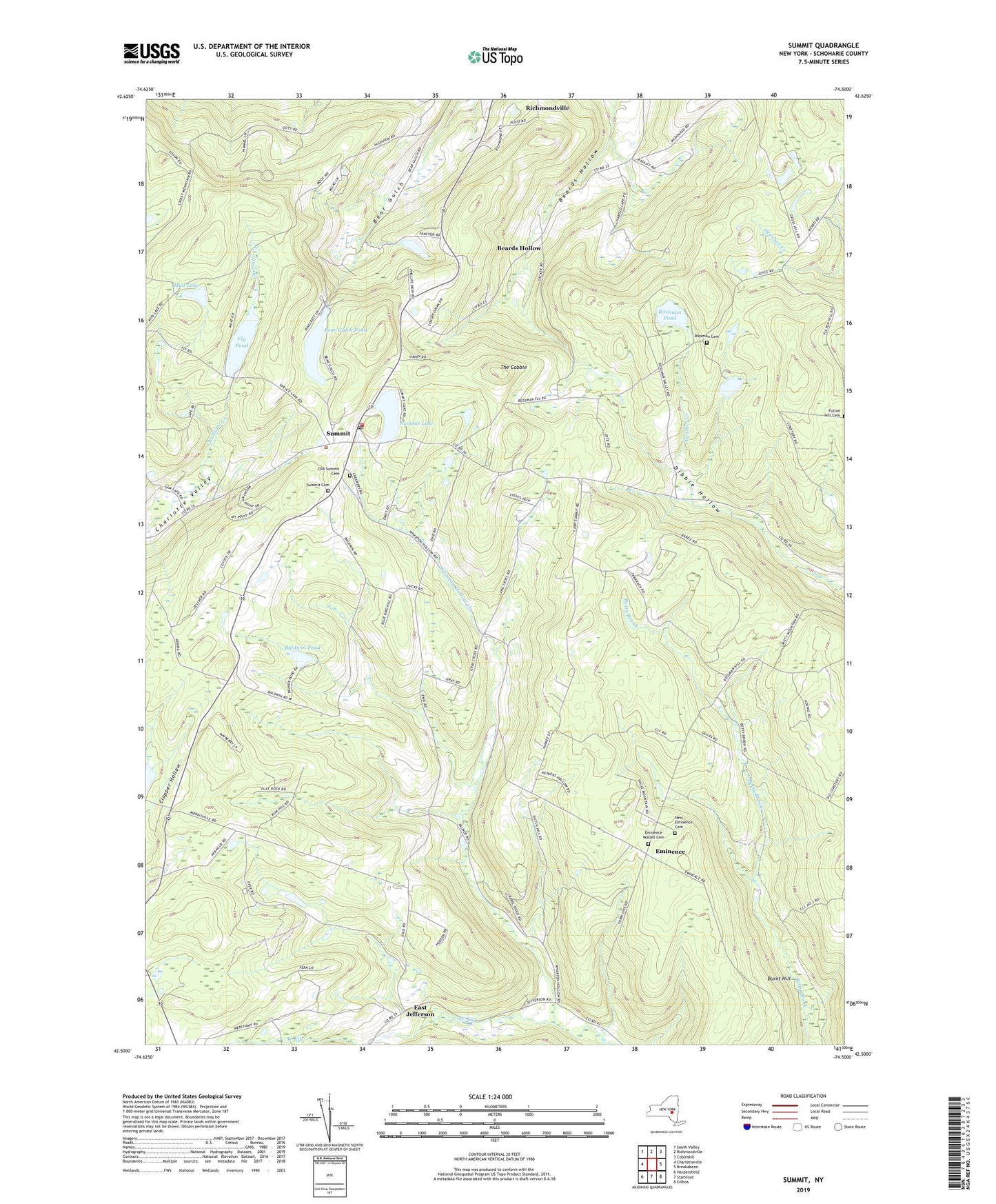
2023 topographic map quadrangle Summit in the state of New York. Scale: 1:24000. Based on the newly updated USGS 7.5' US Topo map series, this map is in the following counties: Schoharie. The map contains contour data, water features, and other items you are used to seeing on USGS maps, but also has updated roads and other features. This is the next generation of topographic maps. Printed on high-quality waterproof paper with UV fade-resistant inks.
Quads adjacent to this one:
West: Charlotteville
Northwest: South Valley
North: Richmondville
Northeast: Cobleskill
East: Breakabeen
Southeast: Gilboa
South: Stamford
Southwest: Harpersfield
This map covers the same area as the classic USGS quad with code o42074e5.
Contains the following named places: Baldwin Pond, Bear Gulch Pond, Beards Hollow, Camp Summit, Cross Hill School, Dibble Hollow, East Jefferson, Eminence, Eminence Walled Cemetery, Fairland Church, Fly Pond, Mud Lake, New Eminence Cemetery, Old Summit Cemetery, Rossman Cemetery, Rossman Pond, Saint Anna's Catholic Church, Sawyer Hollow, School Number 10, School Number 11, School Number 13, School Number 14, School Number 2, School Number 6, School Number 7, School Number 8, School Number 9, Summit, Summit Cemetery, Summit Lake, Summit Post Office, Summit Town Hall, Summit United Methodist Church, Summit Volunteer Fire Department, The Cobble, Town of Summit, Vorman Corners, Wharton Hollow, Wharton Hollow Creek, ZIP Codes: 12149, 12175