MyTopo
Sparrowhawk Point New York US Topo Map
Couldn't load pickup availability
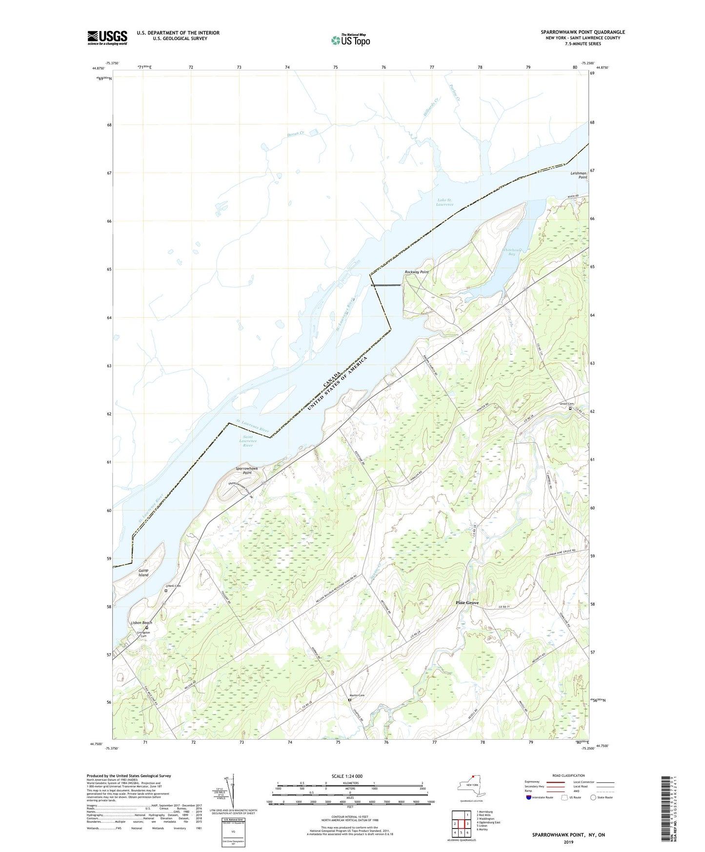
2023 topographic map quadrangle Sparrowhawk Point in the state of New York. Scale: 1:24000. Based on the newly updated USGS 7.5' US Topo map series, this map is in the following counties: St. Lawrence. The map contains contour data, water features, and other items you are used to seeing on USGS maps, but also has updated roads and other features. This is the next generation of topographic maps. Printed on high-quality waterproof paper with UV fade-resistant inks.
Quads adjacent to this one:
West: Red Mills
East: Waddington
Southeast: Morley
South: Lisbon
Southwest: Ogdensburg East
This map covers the same area as the classic USGS quad with code o44075g3.
Contains the following named places: Brown Church, Iroquois Dam, Iroquois Organic Farm, Keystone Dairy, Leading Light, Lisbon Beach, Livingston Cemetery, Lotus Island, Martin Cemetery, Nevin Memorial Church, O'Brian Farms, O'Neill Cemetery, Pine Grove, Rockway Point, School Number 10, School Number 11, School Number 15, School Number 17, School Number 2, School Number 24, School Number 3, Sparrowhawk Point, Squaw Creek, Sucker Brook, Union Cemetery, Whitehouse Bay